Gerbing
Gerbing is a building in Apeldoorn, Veluwe, Gelderland. Gerbing is situated nearby to the health club Curves, as well as near the square Mercatorplein.| Tap on a place to explore it |
Places of Interest Nearby
Highlights include Noorderkerk and Orpheus.
Noorderkerk
Church

Photo: Michielverbeek, CC BY-SA 3.0.
Noorderkerk is a church, which is situated 580 metres southwest of Gerbing.
Orpheus
Theater building
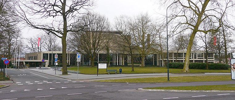
Photo: Erik Wannee, CC0.
Orpheus is a theater building, which is situated 1 km south of Gerbing.

Places in the Area
Nearby places include Wenum and De Haere.
Wenum
Village
Wenum-Wiesel is a twin village in the municipality of Apeldoorn, in the province of Gelderland in the Netherlands. In 1978, the hamlets of Wenum and Wiesel merged into a village. Wenum is situated 3 km north of Gerbing.

Ugchelen
Village
Ugchelen is part of the municipality of Apeldoorn in the Gelderland province of the Netherlands, and is today seen as a village. Ugchelen is located South West of Apeldoorn and has about 7000 inhabitants. Ugchelen is situated 5 km south of Gerbing.
Gerbing
- Type: Commercial building
- Categories: building and office
- Location: Apeldoorn, Veluwe, Gelderland, Eastern Netherlands, Netherlands, Benelux, Europe
- View on OpenStreetMap
Latitude
52.22791° or 52° 13′ 41″ northLongitude
5.95734° or 5° 57′ 26″ eastInception
1974Open location code
9F476XH4+5WOpenStreetMap ID
way 263003185OpenStreetMap feature
building=commercial
This page is based on OpenStreetMap, Wikidata, and Wikimedia Commons.
We’d love your help improving our open data sources. Thank you for contributing.
Satellite Map
Discover Gerbing from above in high-definition satellite imagery.
Notable Places Nearby
Highlights include Curves and Mercatorplein.
Nearby Places
Explore places such as B&K Repro-Service and Eigen Stijl.
Veluwe: Must-Visit Destinations
Delve into Ede, Wageningen, Harderwijk, and Elburg.
Curious Places to Discover
Uncover intriguing places from every corner of the globe.
About Mapcarta. Data © OpenStreetMap contributors and available under the Open Database License". Text is available under the CC BY-SA 4.0 license, except for photos, directions, and the map. Photo: Kleinleugenmors, CC BY-SA 3.0.