Bois de Bondy
Bois de Bondy is a park in Bondy, Arrondissement of Bobigny, Île-de-France. Bois de Bondy is situated nearby to the playground Tyrolienne, as well as near Aire des pins.| Tap on a place to explore it |
Places of Interest Nearby
Highlights include Cimetière intercommunal de Bondy - Le Pré-Saint-Gervais and Hôpital Jean-Verdier.
Cimetière intercommunal de Bondy - Le Pré-Saint-Gervais
Cemetery

Photo: Chabe01, CC BY-SA 4.0.
Cimetière intercommunal de Bondy - Le Pré-Saint-Gervais is a cemetery, which is situated 290 metres north of Bois de Bondy.
Hôpital Jean-Verdier
Hospital
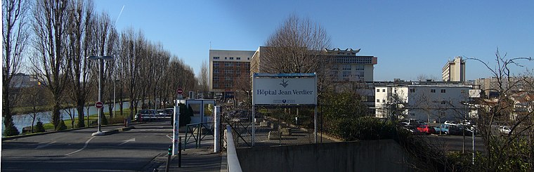
Photo: Suaudeau, CC BY-SA 3.0.
Hôpital Jean-Verdier is a hospital, which is situated 600 metres south of Bois de Bondy.
Cimetière ancien des Pavillons-sous-Bois
Cemetery

Photo: Chabe01, CC BY-SA 4.0.
Cimetière ancien des Pavillons-sous-Bois is a cemetery, which is situated 420 metres northeast of Bois de Bondy.
Places in the Area
Nearby places include Les Pavillons-sous-Bois and Bondy.
Les Pavillons-sous-Bois
Town

Photo: Binche, CC BY-SA 3.0.
Les Pavillons-sous-Bois is a commune in the eastern suburbs of Paris, France. It is located 12.8 km from the center of Paris.
Bondy
Town

Photo: Chabe01, CC BY-SA 4.0.
Bondy is a commune in the northeastern suburbs of Paris, France. It is located 10.9 km from the centre of Paris, in the Seine-Saint-Denis department.
Aulnay-sous-Bois
Town

Photo: Suaudeau, CC BY-SA 3.0.
Aulnay-sous-Bois is a commune in the Seine-Saint-Denis department in the Île-de-France region in the north-eastern suburbs of Paris, France. It is located 13.9 km from the Kilometre zero of France.
Bois de Bondy
- Type: Park
- Category: recreation area
- Location: Bondy, Arrondissement of Bobigny, Seine-Saint-Denis, Île-de-France, France, Europe
- View on OpenStreetMap
Latitude
48.915° or 48° 54′ 54″ northLongitude
2.48829° or 2° 29′ 18″ eastOperator
Est EnsembleOpen location code
8FW4WF7Q+X8OpenStreetMap ID
way 26375431OpenStreetMap feature
leisure=park
This page is based on OpenStreetMap, Wikidata, and Wikimedia Commons.
We’d love your help improving our open data sources. Thank you for contributing.
Satellite Map
Discover Bois de Bondy from above in high-definition satellite imagery.
Notable Places Nearby
Highlights include Tyrolienne and Aire des pins.
Nearby Places
Explore places such as IRD Institut de recherche pour le développement and Ronsard - Villon.
Île-de-France: Must-Visit Destinations
Delve into Paris, Versailles, Boulogne-Billancourt, and Paris Charles de Gaulle Airport.
Curious Parks to Discover
Uncover intriguing parks from every corner of the globe.
About Mapcarta. Data © OpenStreetMap contributors and available under the Open Database License". Text is available under the CC BY-SA 4.0 license, except for photos, directions, and the map. Photo: Romain D C, CC BY-SA 3.0.