Ysgol Maes Y Mynydd
Ysgol Maes Y Mynydd is a school in Rhosllanerchrugog, Wrexham, Wales. Ysgol Maes Y Mynydd is situated nearby to the pub Sun Inn, as well as near the school Ysgol-Y-Grango.| Tap on a place to explore it |
- Type: School
- Description: school in Wrexham, UK
- Also known as: “Ysgol Maes y Mynydd”
Places of Interest Nearby
Highlights include Stiwt Theatr and Penuel Welsh Baptist Church.
Stiwt Theatr
Theater building

Photo: Cymrodor, CC BY-SA 3.0.
Stiwt Theatr is a theater building, which is situated 1,700 feet southeast of Ysgol Maes Y Mynydd.
Penuel Welsh Baptist Church
Church

Photo: Peter Craine, CC BY-SA 2.0.
Penuel Welsh Baptist Church is situated 1,300 feet south of Ysgol Maes Y Mynydd.
St David’s Welsh Church
Church

Photo: Peter Craine, CC BY-SA 2.0.
St David's Welsh Church is located on Broad Street, in Rhosllanerchrugog, Wrexham County Borough, Wales. The church was built in 1892 to a design by Douglas and Fordham of Chester. St David’s Welsh Church is situated 1,600 feet southeast of Ysgol Maes Y Mynydd.
Places in the Area
Nearby places include Rhosllanerchrugog and Llwyneinion.
Rhosllanerchrugog
Village
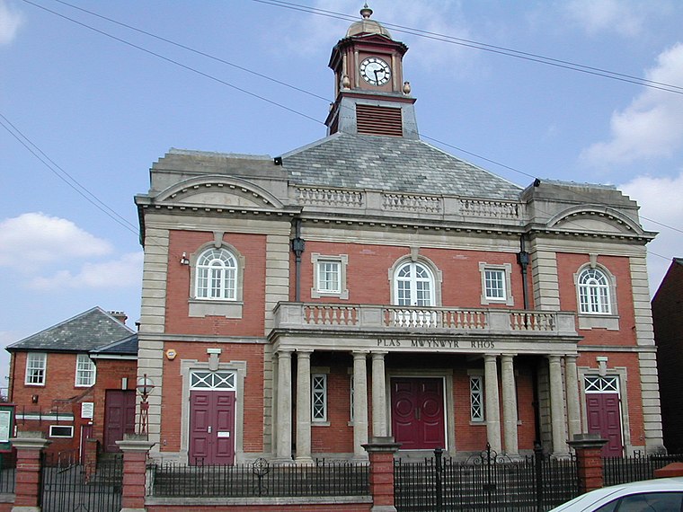
Photo: Jaseman125, Public domain.
Rhosllanerchrugog is a village and community in Wrexham County Borough, Wales. It lies within the historic county of Denbighshire. The entire built-up area including Penycae, Ruabon and Cefn Mawr had a population of 25,362.
Llwyneinion
Hamlet
Llwyneinion is a village in Wrexham County Borough, Wales. It is part of the community of Esclusham. Its name can be translated from the Welsh language as "Einion's Grove", although until at least the 19th century the name was more commonly written as Llwynenion, "Enion's Grove".
Ponciau
Village

Photo: Jaseman125, CC BY-SA 3.0.
Ponciau is a village within the community of Rhosllanerchrugog, Wrexham County Borough, Wales. It is close to the villages of Legacy, Pentre Bychan, and Johnstown and is overlooked by Ruabon Mountain.
Ysgol Maes Y Mynydd
- Categories: primary school, building, and education
- Location: Rhosllanerchrugog, Wrexham, Wales, United Kingdom, Britain and Ireland, Europe
- View on OpenStreetMap
Latitude
53.01555° or 53° 0′ 56″ northLongitude
-3.05976° or 3° 3′ 35″ westOpen location code
9C5R2W8R+63OpenStreetMap ID
way 264656856OpenStreetMap feature
amenity=schoolOpenStreetMap feature
building=yesWikidata ID
Q66008709
This page is based on OpenStreetMap, Wikidata, and Wikimedia Commons.
We’d love your help improving our open data sources. Thank you for contributing.
Satellite Map
Discover Ysgol Maes Y Mynydd from above in high-definition satellite imagery.
In Other Languages
“Ysgol Maes Y Mynydd” goes by many names.
- Welsh: “Ysgol Maes Y Mynydd”
Notable Places Nearby
Highlights include Sun Inn and Ysgol-Y-Grango.
Nearby Places
Explore places such as Y Bwthyn and Imperial Windows.
Wales: Must-Visit Destinations
Delve into Cardiff, Swansea, Newport, and Llanfairpwllgwyngyll.
Curious Places to Discover
Uncover intriguing places from every corner of the globe.
About Mapcarta. Data © OpenStreetMap contributors and available under the Open Database License". Text is available under the CC BY-SA 4.0 license, except for photos, directions, and the map. Photo: Wikimedia, CC0.