Thomas More Church (Schlebusch)
Thomas More Church (Schlebusch) is a church in Leverkusen, Cologne District, North Rhine-Westphalia. Thomas More Church (Schlebusch) is situated nearby to the government office Stadt Leverkusen - Fachbereich 53 Medizinischer Dienst, as well as near the garden Vitamed.| Tap on a place to explore it |
Photo: A.Savin, CC BY-SA 3.0.
- Type: Church
- Denomination: Roman Catholic
- Description: church building in Schlebusch, Germany
Places of Interest Nearby
Highlights include Morsbroich Castle and Kirche zu Schlebusch.
Morsbroich Castle
Museum

Photo: Marcin-Janek, CC BY 3.0.
Morsbroich Castle is a museum, which is situated 1 km north of Thomas More Church (Schlebusch).
Kirche zu Schlebusch
Church
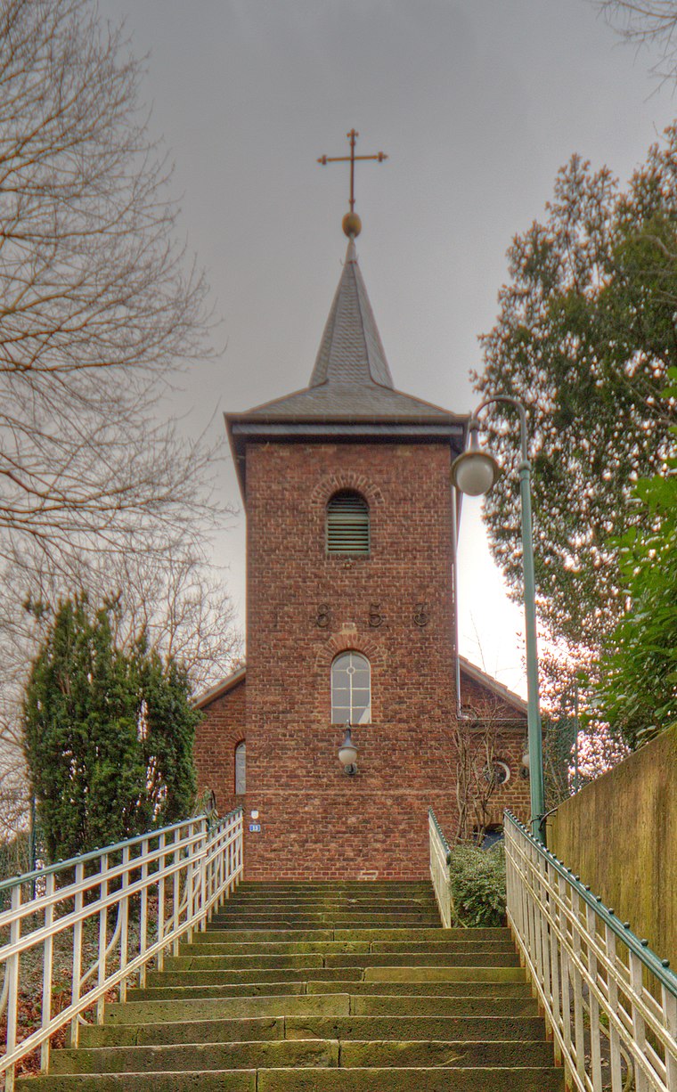
Photo: A.Savin, CC BY-SA 3.0.
Kirche zu Schlebusch is a church, which is situated 1 km east of Thomas More Church (Schlebusch).
Leverkusen-Manfort station
Railway station

Photo: A.Savin, CC BY-SA 3.0.
Leverkusen-Manfort station is a through station in the district of Manfort of the city of Leverkusen in the German state of North Rhine-Westphalia. It was named after the nearby town of Schlebusch and opened on 25 August 1867 on the Gruiten–Köln-Deutz railway, which was completed between the former Bergisch-Märkische Railway Company station in Mülheim and Opladen by the BME on 1 May 1868. Leverkusen-Manfort station is situated 1½ km west of Thomas More Church (Schlebusch).
Places in the Area
Nearby places include Osenau and Biesenbach.
Osenau
Village
 Osenau is a village, which is situated 4½ km east of Thomas More Church (Schlebusch).
Biesenbach
Village

Photo: DiAuras, CC BY-SA 4.0.
Biesenbach is a village, which is situated 4½ km north of Thomas More Church (Schlebusch).
Opladen
Suburb
Opladen, now a district of Leverkusen, used to be the capital of the Rhein-Wupper-Kreis until 1975. Opladen station is located 15 kilometres northeast from Cologne on the railway to Wuppertal. Opladen is situated 5 km northwest of Thomas More Church (Schlebusch).
Thomas More Church (Schlebusch)
- Categories: building, place of worship, and religion
- Location: Leverkusen, Cologne District, Cologne Lowland, North Rhine-Westphalia, Germany, Central Europe, Europe
- View on OpenStreetMap
Latitude
51.02827° or 51° 1′ 42″ northLongitude
7.03461° or 7° 2′ 5″ eastOpen location code
9F3922HM+8ROpenStreetMap ID
way 267417932OpenStreetMap feature
amenity=place_of_worshipOpenStreetMap feature
building=churchOpenStreetMap attribute
denomination=roman_catholicWikidata ID
Q2323364
This page is based on OpenStreetMap, Wikidata, and Wikimedia Commons.
We’d love your help improving our open data sources. Thank you for contributing.
Satellite Map
Discover Thomas More Church (Schlebusch) from above in high-definition satellite imagery.
In Other Languages
From German to Russian—“Thomas More Church (Schlebusch)” goes by many names.
- German: “St. Thomas Morus”
- Russian: “Церковь св. Томаса Мора”
Notable Places Nearby
Highlights include Stadt Leverkusen - Fachbereich 53 Medizinischer Dienst and Vitamed.
Nearby Places
Explore places such as Karl-Carstens-Ring and Karl-Carstens-Ring.
Cologne Lowland: Must-Visit Destinations
Delve into Cologne, Bonn, Siegburg, and Bad Honnef.
Curious Churches to Discover
Uncover intriguing churches from every corner of the globe.
About Mapcarta. Data © OpenStreetMap contributors and available under the Open Database License". Text is available under the CC BY-SA 4.0 license, except for photos, directions, and the map. Photo: A.Savin, CC BY-SA 3.0.