McDonald’s (Verwaltung)
McDonald’s (Verwaltung) is an office building in Mülheim-Kärlich, Mayen-Koblenz, Rhineland-Palatinate which is located on Gebrüder-Pauken-Straße. McDonald’s (Verwaltung) is situated nearby to Rheinlandhalle, as well as near the community center TV 05 Mülheim.| Tap on a place to explore it |
Places of Interest Nearby
Highlights include Church of the Assumption of Mary and St. Mauritius.
Church of the Assumption of Mary
Church

Photo: Spurzem, CC BY-SA 2.0 de.
Church of the Assumption of Mary is situated 1¼ km southwest of McDonald’s (Verwaltung).
St. Mauritius
Church

Photo: Wikimedia, CC BY-SA 2.0 de.
St. Mauritius is a church, which is situated 2 km west of McDonald’s (Verwaltung).
Jewish cemetery, Mülheim
Cemetery

Photo: Wikimedia, CC BY-SA 3.0.
Jewish cemetery, Mülheim is situated 1½ km southwest of McDonald’s (Verwaltung).
Places in the Area
Nearby places include Koblenz-Rübenach and Urmitz.
Koblenz-Rübenach
Suburb

Photo: Schaengel, CC BY-SA 3.0 de.
Koblenz-Rübenach is a suburb, which is situated 2½ km south of McDonald’s (Verwaltung).
Urmitz
Village

Photo: Möwe-rhein601, CC BY-SA 3.0 de.
Urmitz is a municipality in the district of Mayen-Koblenz in Rhineland-Palatinate, western Germany. In the 4th millennium BC it contained one of the largest fortified settlements of the time. Urmitz is situated 2½ km north of McDonald’s (Verwaltung).
Kaltenengers
Village
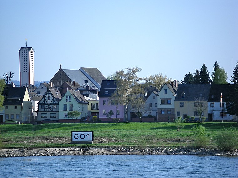
Photo: Volkes Stimme, CC BY-SA 3.0 de.
Kaltenengers is a municipality in the district of Mayen-Koblenz in Rhineland-Palatinate, western Germany. Kaltenengers is situated 3½ km northeast of McDonald’s (Verwaltung).
McDonald’s (Verwaltung)
- Type: Office building
- Address: Gebrüder-Pauken-Straße 23, Mülheim-Kärlich, 56218
- Categories: building and office
- Location: Mülheim-Kärlich, Mayen-Koblenz, Rhineland-Palatinate, Germany, Central Europe, Europe
- View on OpenStreetMap
Latitude
50.39227° or 50° 23′ 32″ northLongitude
7.51065° or 7° 30′ 38″ eastBrand
McDonald’sOpen location code
9F299GR6+W7OpenStreetMap ID
way 270634960OpenStreetMap feature
building=office
This page is based on OpenStreetMap, Wikidata, and Wikimedia Commons.
We’d love your help improving our open data sources. Thank you for contributing.
Satellite Map
Discover McDonald’s (Verwaltung) from above in high-definition satellite imagery.
Notable Places Nearby
Highlights include Rheinlandhalle and TV 05 Mülheim.
Nearby Places
Explore places such as Viessmann Deutschland and Ratiodata SE.
Rhineland-Palatinate: Must-Visit Destinations
Delve into Mainz, Trier, Koblenz, and Worms.
Curious Office Buildings to Discover
Uncover intriguing office buildings from every corner of the globe.
About Mapcarta. Data © OpenStreetMap contributors and available under the Open Database License". Text is available under the CC BY-SA 4.0 license, except for photos, directions, and the map. Photo: Traveler100, CC BY-SA 3.0.