Garston Farm Airstrip
Garston Farm Airstrip is a runway in Marshfield, South Gloucestershire, England. Garston Farm Airstrip is situated nearby to the forest Cloud Wood, as well as near Marshfield Church of England Primary School.| Tap on a place to explore it |
Places of Interest Nearby
Highlights include Bury Camp and St Catherine’s Court.
Bury Camp
Archaeological site
 Bury Camp is the site of an Iron Age multivallate hillfort in north-west Wiltshire, England. It occupies a triangular promontory of Colerne Down, in the north of Colerne parish, at the southern edge of the Cotswold Hills between two spurs of a river valley. Bury Camp is situated 1½ miles east of Garston Farm Airstrip.
St Catherine’s Court
Manor estate
St Catherine's Court is a manor house in a secluded valley north of Bath, Somerset, England. It is a Grade I listed property. The gardens are Grade II* listed on the Register of Historic Parks and Gardens of special historic interest in England. St Catherine’s Court is situated 2 miles south of Garston Farm Airstrip.
Church of St James, North Wraxall
Church

Photo: My another account, Public domain.
Church of St James, North Wraxall is situated 2 miles northeast of Garston Farm Airstrip.
Places in the Area
Nearby places include Marshfield and The Shoe.
Marshfield
Village

Photo: My another account, Public domain.
Marshfield is a village in the local-government area of South Gloucestershire, England, on the borders of the counties of Wiltshire and Somerset. Its toponym derives from the Old English word "march", meaning "a border", hence "Border Field" would be a literal translation.
The Shoe
Hamlet

Photo: Deipnosophista, CC BY-SA 3.0.
The Shoe is a hamlet in the parish of North Wraxall, in the north-west of Wiltshire in England. It lies at the junction of the Fosse Way and the A420. The settlement is named after the former inn called The Horse-shoe and is about 7 miles west of Chippenham and the same distance northeast of Bath.
North Wraxall
Village
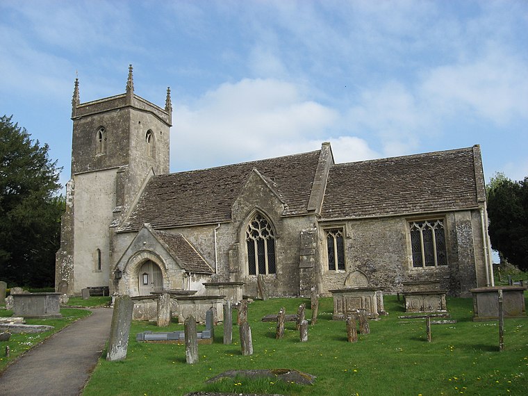
Photo: Robert Powell, CC BY-SA 3.0.
North Wraxall is a village and civil parish in Wiltshire, England. The village is about 6 miles west of Chippenham, just north of the A420 road between Chippenham and Bristol. North Wraxall is situated 2 miles northeast of Garston Farm Airstrip.
Garston Farm Airstrip
- Type: Runway
- Category: transportation
- Location: Marshfield, South Gloucestershire, England, United Kingdom, Britain and Ireland, Europe
- View on OpenStreetMap
Latitude
51.46054° or 51° 27′ 38″ northLongitude
-2.30156° or 2° 18′ 6″ westOpen location code
9C3VFM6X+69OpenStreetMap ID
way 27114057OpenStreetMap feature
aeroway=runway
This page is based on OpenStreetMap, Wikidata, and Wikimedia Commons.
We’d love your help improving our open data sources. Thank you for contributing.
Satellite Map
Discover Garston Farm Airstrip from above in high-definition satellite imagery.
Notable Places Nearby
Highlights include Garston Farm Airstrip and Cloud Wood.
Nearby Places
Explore places such as Garston Farm and Wheatfield Barns.
England: Must-Visit Destinations
Delve into London, Manchester, Sheffield, and Leeds.
Curious Runways to Discover
Uncover intriguing runways from every corner of the globe.
About Mapcarta. Data © OpenStreetMap contributors and available under the Open Database License". Text is available under the CC BY-SA 4.0 license, except for photos, directions, and the map. Photo: sidibousaid, CC BY 2.0.