Schotbalkloods
Schotbalkloods is a building in Gorinchem, Alblasserwaard-Drechtsteden, South Holland. Schotbalkloods is situated nearby to the bridge Korte brug, as well as near De Tuinen.| Tap on a place to explore it |
Photo: Wikimedia, CC BY-SA 4.0.
Places of Interest Nearby
Highlights include Gorinchem railway station and Joods Monument.
Gorinchem railway station
Railway station
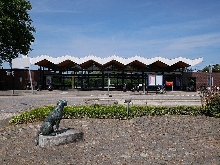
Photo: Fantaglobe11, CC BY-SA 4.0.
Gorinchem is a railway station in the town of Gorinchem, Netherlands. It is on the MerwedeLingelijn. It was opened on 1 December 1883. Train services are operated by Qbuzz. Gorinchem railway station is situated 310 metres north of Schotbalkloods.
Joods Monument
Memorial

Photo: Wikifrits, CC BY-SA 3.0.
Joods Monument is a memorial, which is situated 110 metres east of Schotbalkloods.
Waterstaatskerk Gorinchem
Church

Photo: Stunteltje, CC BY-SA 3.0 nl.
Waterstaatskerk Gorinchem is a church, which is situated 250 metres east of Schotbalkloods.
Places in the Area
Nearby places include Sleeuwijk and Oudendijk.
Sleeuwijk
Village

Photo: Wikimedia, CC BY-SA 4.0.
Sleeuwijk is a village in the Dutch province of North Brabant and part of the municipality of Altena.

Dalem
Village
Dalem is a village in the Tielerwaard region in the municipality of Gorinchem, in the Dutch province of South Holland. The village belonged to the province of Gelderland until 1986 and was part of the former municipality of Vuren. Dalem is situated 3 km east of Schotbalkloods.
Schotbalkloods
- Type: Building
- Roof shape: gabled
- Category: shed
- Location: Gorinchem, Alblasserwaard-Drechtsteden, South Holland, Western Netherlands, Netherlands, Benelux, Europe
- View on OpenStreetMap
Latitude
51.83091° or 51° 49′ 51″ northLongitude
4.96888° or 4° 58′ 8″ eastInception
1900Levels
1Open location code
9F36RXJ9+9HOpenStreetMap ID
way 273805825OpenStreetMap feature
building=shedOpenStreetMap attribute
roof-shape=gabledWikidata ID
Q17603524
This page is based on OpenStreetMap, Wikidata, and Wikimedia Commons.
We’d love your help improving our open data sources. Thank you for contributing.
Satellite Map
Discover Schotbalkloods from above in high-definition satellite imagery.
In Other Languages
“Schotbalkloods” goes by many names.
- Dutch: “rijksmonumentnummer 525129”
- Dutch: “Schotbalkloods”
Notable Places Nearby
Highlights include Korte brug and De Tuinen.
Nearby Places
Explore places such as Verloskundige Praktijk De Nieuwelinge and Metropole.
Alblasserwaard-Drechtsteden: Must-Visit Destinations
Delve into Dordrecht, Kinderdijk, Sliedrecht, and Zwijndrechtse Waard.
Curious Buildings to Discover
Uncover intriguing buildings from every corner of the globe.
About Mapcarta. Data © OpenStreetMap contributors and available under the Open Database License". Text is available under the CC BY-SA 4.0 license, except for photos, directions, and the map. Photo: Wikimedia, CC BY-SA 4.0.