Zorgpark Scharn
Zorgpark Scharn is an ambulance station in Maastricht, South Limburg, Limburg which is located on Vijverdalseweg. Zorgpark Scharn is situated nearby to the building Sint-Maartenscollege, as well as near the office building Withuishof Castle Farm.| Tap on a place to explore it |
Places of Interest Nearby
Highlights include Antonius van Paduakerk and De Geusselt.
Antonius van Paduakerk
Church

Photo: Wikimedia, Public domain.
Antonius van Paduakerk is a church, which is situated 530 metres southwest of Zorgpark Scharn.
De Geusselt
Stadium
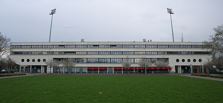
Photo: A.Savin, CC BY-SA 3.0.
Stadion de Geusselt is a multi-use stadium in Maastricht, Netherlands. It is currently used mostly for football matches and is the home stadium of MVV Maastricht. The stadium is able to hold 10,000 people and was built in 1961. The pitch is artificial turf. De Geusselt is situated 1¼ km northwest of Zorgpark Scharn.
Sint-Maartenscollege
Building

Photo: Kleon3, CC BY-SA 3.0.
The Sint-Maartenscollege is a state secondary school located in Maastricht, the Netherlands. It operates across two buildings and offers all streams of the Dutch secondary education system, including VMBO, HAVO, and VWO. Sint-Maartenscollege is situated 310 metres southwest of Zorgpark Scharn.
Places in the Area
Nearby places include Geusseltpark and Heer.

Heer
Neighborhood
Heer is a neighbourhood of Maastricht, in the Dutch province of Limburg. Heer is a former municipality and village, incorporated into Maastricht in 1970 and, until 1828, this municipality was called "Heer en Keer".
Amby
Neighborhood
A former village, Amby is now a neighborhood of Maastricht, in the Netherlands, located about 4 km northeast of the center of the city. From January 2, 1839, to July 1, 1970, Amby existed as a separate municipality.
Zorgpark Scharn
- Type: Ambulance station
- Address: Vijverdalseweg 2, Maastricht, 6226NB
- Categories: building and health care
- Location: Maastricht, South Limburg, Limburg, Southern Netherlands, Netherlands, Benelux, Europe
- View on OpenStreetMap
Latitude
50.85047° or 50° 51′ 2″ northLongitude
5.73077° or 5° 43′ 51″ eastInception
2014Operator
GGD Zuid-LimburgOpen location code
9F27VP2J+58OpenStreetMap ID
way 276528631OpenStreetMap feature
building=yes
This page is based on OpenStreetMap, Wikidata, and Wikimedia Commons.
We’d love your help improving our open data sources. Thank you for contributing.
Satellite Map
Discover Zorgpark Scharn from above in high-definition satellite imagery.
Notable Places Nearby
Highlights include Withuishof Castle Farm and Oostermaas.
Nearby Places
Explore places such as Service Apotheek Scharn and Stadspoli Oost.
South Limburg: Must-Visit Destinations
Delve into Heerlen, Kerkrade, Valkenburg aan de Geul, and Vaals.
Curious Ambulance Stations to Discover
Uncover intriguing ambulance stations from every corner of the globe.
About Mapcarta. Data © OpenStreetMap contributors and available under the Open Database License". Text is available under the CC BY-SA 4.0 license, except for photos, directions, and the map. Photo: Bodoklecksel, CC BY-SA 3.0.