San Francisco Fire Station 39
San Francisco Fire Station 39 is a fire station in San Francisco, Bay Area, California which is located on Portola Drive. San Francisco Fire Station 39 is situated nearby to the park Edgehill Mountain Open Space, as well as near New Life Church of the Nazarene.| Tap on a place to explore it |
Places of Interest Nearby
Highlights include Mount Davidson and West Portal station.
Mount Davidson
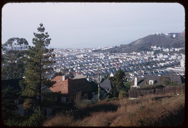
Peak

Photo: Pi.1415926535, CC BY-SA 4.0.
Mount Davidson is the highest natural point in San Francisco, California, with an elevation of 928 feet. Located on the West Side of the city, Mount Davidson sits south of Twin Peaks and Portola Drive and to the west of Diamond Heights and Glen Park.
West Portal station
Railway station

Photo: Pi.1415926535, CC BY-SA 3.0.
West Portal station is a Muni Metro station in the West Portal neighborhood in San Francisco, California. It is built around the western entrance to the Twin Peaks Tunnel. West Portal station is situated 2,100 feet west of San Francisco Fire Station 39.
Mount Davidson cross
Cross

Photo: Troymccluresf, CC BY-SA 3.0.
Mount Davidson cross is situated 1,300 feet southeast of San Francisco Fire Station 39.
Places in the Area
Nearby places include West Portal and Forest Hill.
West Portal
Neighborhood

Photo: Aaron Tait, CC BY 2.0.
West Portal is a small neighborhood located on the West Side of San Francisco, California. West Portal is a primarily residential area of the city. The neighborhood's main corridor, West Portal Avenue, serves as a principal shopping district of southwestern San Francisco.
Forest Hill
Neighborhood

Photo: Pi.1415926535, CC BY-SA 3.0.
Forest Hill is an affluent neighborhood located on the West Side of San Francisco, California. Forest Hill is one of eight master-planned residence parks in San Francisco.
St. Francis Wood
Neighborhood
 St. Francis Wood is a residential neighborhood located on the West Side of San Francisco, California, United States, south of the West Portal neighborhood and west of Mount Davidson.
San Francisco Fire Station 39
- Type: Fire station
- Address: 1091 Portola Drive, San Francisco, CA
- Category: building
- Location: San Francisco, Bay Area, California, United States, North America
- View on OpenStreetMap
Latitude
37.74002° or 37° 44′ 24″ northLongitude
-122.45865° or 122° 27′ 31″ westElevation
492 feet (150 metres)Height
26 feet (8 metres)Operator
San Francisco Fire DepartmentOpen location code
849VPGRR+2GOpenStreetMap ID
way 277445961OpenStreetMap feature
amenity=fire_stationOpenStreetMap feature
building=yes
This page is based on OpenStreetMap, Wikidata, and Wikimedia Commons.
We’d love your help improving our open data sources. Thank you for contributing.
Satellite Map
Discover San Francisco Fire Station 39 from above in high-definition satellite imagery.
Places with the Same Name
Discover other places named “San Francisco Fire Station 39”.
Notable Places Nearby
Highlights include Edgehill Mountain Open Space and New Life Church of the Nazarene.
Nearby Places
Explore places such as Miraloma Drive & Marne Avenue and Miraloma Drive & Marne Avenue.
San Francisco: Must-Visit Destinations
Delve into Golden Gate, Chinatown-North Beach, Civic Center-Tenderloin, and Fisherman’s Wharf.
Curious Fire Stations to Discover
Uncover intriguing fire stations from every corner of the globe.
About Mapcarta. Data © OpenStreetMap contributors and available under the Open Database License". Text is available under the CC BY-SA 4.0 license, except for photos, directions, and the map. Photo: Wikimedia, CC BY-SA 3.0.