Ivas Wood
Ivas Wood is a forest in Stainborough, Barnsley, England. Ivas Wood is situated nearby to the village Stainborough, as well as near Gilroyd.| Tap on a place to explore it |
Places of Interest
Highlights include Locke Park and Oakwell.
Locke Park
Park

Photo: ChicXulub, CC BY-SA 4.0.
Locke Park is a 47-acre public open space and one of the largest outdoor green spaces in the Metropolitan Borough of Barnsley, in South Yorkshire, England.
Oakwell
Stadium
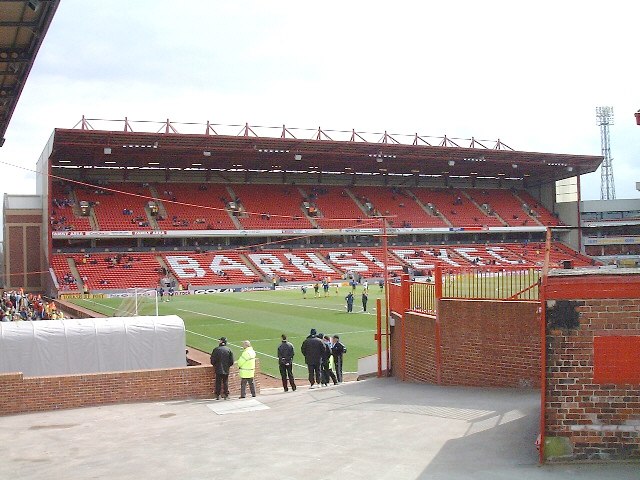
Photo: Martin Thirkettle, CC BY-SA 2.0.
Oakwell is a multi-purpose sports ground in Barnsley, South Yorkshire, England used by Barnsley Football Club for home fixtures, and those of their reserves.
Dodworth railway station
Railway station
Dodworth railway station serves the village of Dodworth, in the Metropolitan Borough of Barnsley, South Yorkshire, England. The station is 2 miles 71 chains west of Barnsley on the Penistone Line between Huddersfield and Sheffield.
Places in the Area
Nearby places include Worsbrough and Hoyland.
Worsbrough
Village

Photo: Dave Bevis, CC BY-SA 2.0.
Worsbrough is a district 2 to 3 miles south of Barnsley in the metropolitan borough of Barnsley, South Yorkshire, England. Before 1974, Worsbrough had its own urban district council in the West Riding of Yorkshire.
Hoyland
Town

Photo: Chemical Engineer, CC BY-SA 4.0.
Hoyland is a town in the Metropolitan Borough of Barnsley in South Yorkshire, England. The town has also been known as Nether Hoyland. When the urban district council was formed the name used was Hoyland Nether Urban District Council.
Dodworth
Village

Photo: ChicXulub, CC BY-SA 4.0.
Dodworth is a village in the metropolitan borough of Barnsley in South Yorkshire, England. Historically part of the West Riding of Yorkshire, it has a population of 5,742, increasing to 5,900 at the 2011 Census.
Ivas Wood
- Type: Forest
- Location: Stainborough, Barnsley, England, United Kingdom, Britain and Ireland, Europe
- View on OpenStreetMap
Latitude
53.5231° or 53° 31′ 23″ northLongitude
-1.5031° or 1° 30′ 11″ westOpen location code
9C5WGFFW+6QOpenStreetMap ID
way 281390379OpenStreetMap feature
natural=wood
This page is based on OpenStreetMap, Wikidata, and Wikimedia Commons.
We’d love your help improving our open data sources. Thank you for contributing.
Satellite Map
Discover Ivas Wood from above in high-definition satellite imagery.
Localities in the Area
Explore places such as Stainborough and Gilroyd.
Notable Places Nearby
Highlights include Queen Annes Obelisk and The Serpentine.
England: Must-Visit Destinations
Delve into London, Manchester, Sheffield, and Leeds.
Curious Forests to Discover
Uncover intriguing forests from every corner of the globe.
About Mapcarta. Data © OpenStreetMap contributors and available under the Open Database License". Text is available under the CC BY-SA 4.0 license, except for photos, directions, and the map. Photo: Badics, CC BY-SA 3.0.