9ª Brigada de Infantaria Motorizada
9ª Brigada de Infantaria Motorizada is a military installation in Rio de Janeiro, Grande Rio, Rio de Janeiro. 9ª Brigada de Infantaria Motorizada is situated nearby to the park Praça do Canhão, as well as near the hospital UPA Realengo.| Tap on a place to explore it |
Places of Interest Nearby
Highlights include Estação Mocidade Padre Miguel and Unidos de Padre Miguel.
Estação Mocidade Padre Miguel
Railway station
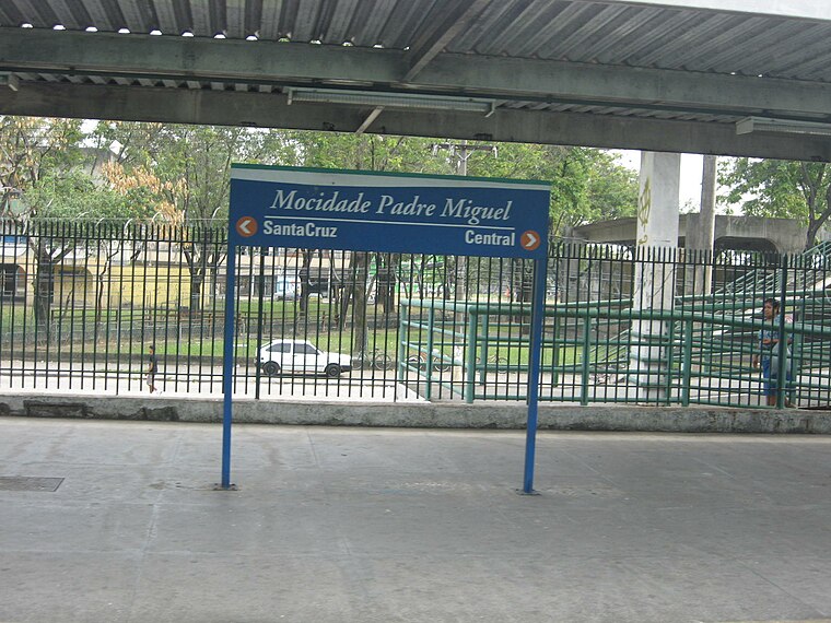
Photo: Junius, Public domain.
Estação Mocidade Padre Miguel is a railway station, which is situated 1½ km west of 9ª Brigada de Infantaria Motorizada.
Unidos de Padre Miguel
Community center

Photo: Ricardo Almeida Fotógrafo, CC BY-SA 4.0.
The Grêmio Recreativo Escola de Samba Unidos de Padre Miguel is a samba school of the city of Rio de Janeiro, being located on Rua Mesquita in the neighborhood of Padre Miguel. Unidos de Padre Miguel is situated 1½ km west of 9ª Brigada de Infantaria Motorizada.
Deodoro Stadium
Stadium

Photo: Wikimedia, CC BY 3.0 br.
Deodoro Stadium is a temporary stadium at Deodoro Modern Pentathlon Park in Rio de Janeiro, Brazil. The stadium hosted rugby sevens and modern pentathlon events during the 2016 Summer Olympics. Deodoro Stadium is situated 3 km northeast of 9ª Brigada de Infantaria Motorizada.
Places in the Area
Nearby places include Realengo and Padre Miguel.
Realengo
Suburb

Photo: Wikimedia, CC BY-SA 2.5.
Realengo is a neighborhood in the West Zone of Rio de Janeiro, Brazil. The lower and middle-class neighborhood is between the Mendanha and Pedra Branca mountains.
Padre Miguel
Suburb
The neighborhood of Padre Miguel is situated in the western region of the city of Rio de Janeiro, is of middle class, and borders the neighborhoods of Bangu and Realengo.
Magalhães Bastos
Suburb
Magalhães Bastos is a neighborhood in the West Zone of Rio de Janeiro, Brazil.
9ª Brigada de Infantaria Motorizada
- Type: Military installation
- Location: Rio de Janeiro, Grande Rio, Rio de Janeiro, Southeast, Brazil, South America
- View on OpenStreetMap
Latitude
-22.87563° or 22° 52′ 32″ southLongitude
-43.43336° or 43° 26′ 0″ westOpen location code
589R4HF8+QMOpenStreetMap ID
way 290452701OpenStreetMap feature
landuse=military
This page is based on OpenStreetMap, Wikidata, and Wikimedia Commons.
We’d love your help improving our open data sources. Thank you for contributing.
Satellite Map
Discover 9ª Brigada de Infantaria Motorizada from above in high-definition satellite imagery.
Notable Places Nearby
Highlights include Praça do Canhão and UPA Realengo.
Nearby Places
Explore places such as Drogaria Pacheco and Itaú.
Rio de Janeiro: Must-Visit Destinations
Delve into Zona Sul, Centro, Rio de Janeiro–Galeão International Airport, and Zona Norte.
Curious Military Installations to Discover
Uncover intriguing military installations from every corner of the globe.
About Mapcarta. Data © OpenStreetMap contributors and available under the Open Database License". Text is available under the CC BY-SA 4.0 license, except for photos, directions, and the map. Photo: Wolfhardt, CC BY-SA 3.0.