Escuela Educación Infantil Atalía
Escuela Educación Infantil Atalía is a kindergarten in Gijón, Asturias. Escuela Educación Infantil Atalía is situated nearby to the playground Parque Atalia, as well as near the suburb El Natahoyo.| Tap on a place to explore it |
- Type: Kindergarten
- Address: Gijón/Xixón
- Wheelchair access: yes
Places of Interest Nearby
Highlights include Gijón Railway Station and Aquarium of Gijón.
Gijón Railway Station
Railway station
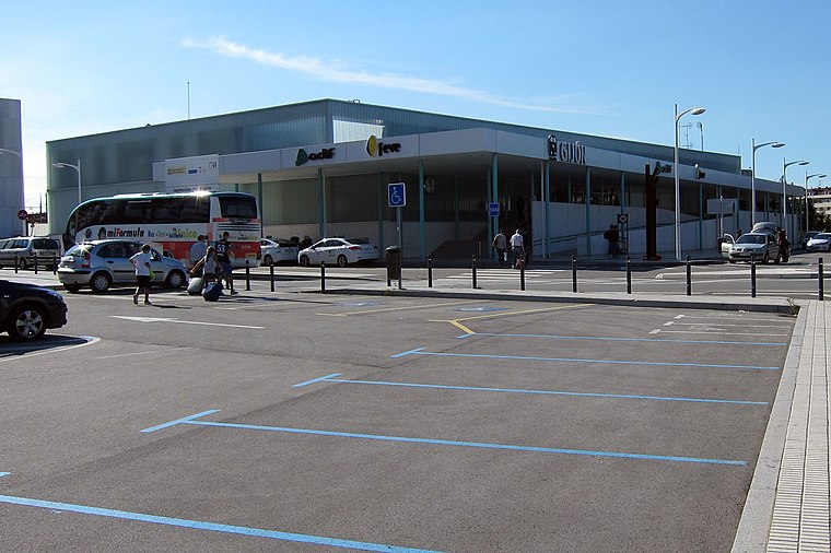
Photo: FDV, CC BY-SA 3.0.
Gijón Railway Station, also known as Gijón Sanz Crespo, is the main railway station of Gijón, Spain. Since 2011 it is located in Sanz Crespo street due to the works for the Metrotrén Asturias project. Gijón Railway Station is situated 640 metres east of Escuela Educación Infantil Atalía.
Aquarium of Gijón
Public aquarium
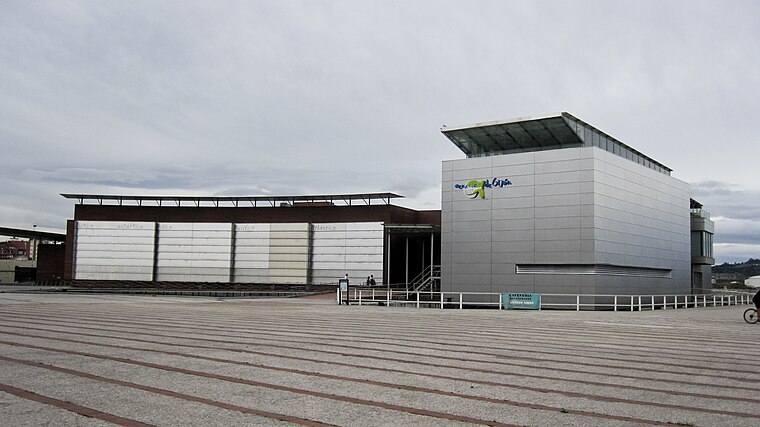
Photo: Xauxa, CC BY-SA 3.0.
Aquarium of Gijón is a public aquarium, which is situated 640 metres northeast of Escuela Educación Infantil Atalía.
Silken Ciudad Gijón
Hotel
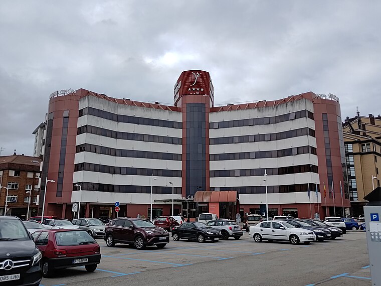
Photo: IM027, CC BY-SA 4.0.
Silken Ciudad Gijón is a hotel, which is situated 710 metres east of Escuela Educación Infantil Atalía.
Places in the Area
Nearby places include El Natahoyo and Moreda.


Escuela Educación Infantil Atalía
- Category: education
- Location: Gijón, Asturias, Green Spain, Spain, Iberia, Europe
- View on OpenStreetMap
Latitude
43.53893° or 43° 32′ 20″ northLongitude
-5.68339° or 5° 41′ 0″ westHeight
6 metres (20 feet)Open location code
8CMPG8Q8+HJOpenStreetMap ID
way 293936446OpenStreetMap feature
amenity=kindergartenOpenStreetMap attribute
wheelchair=yes
This page is based on OpenStreetMap, Wikidata, and Wikimedia Commons.
We’d love your help improving our open data sources. Thank you for contributing.
Satellite Map
Discover Escuela Educación Infantil Atalía from above in high-definition satellite imagery.
Notable Places Nearby
Highlights include Parque Atalia and Pista Parque Atalía.
Nearby Places
Explore places such as Casa Antidio and Colegio Público Atalía.
Asturias: Must-Visit Destinations
Delve into Oviedo, Aviles, Villaviciosa, and Grado.
Curious Kindergartens to Discover
Uncover intriguing kindergartens from every corner of the globe.
About Mapcarta. Data © OpenStreetMap contributors and available under the Open Database License". Text is available under the CC BY-SA 4.0 license, except for photos, directions, and the map. Photo: charles lecompte, CC BY-SA 3.0.