Straußenfarm Gemarkenhof
Straußenfarm Gemarkenhof is a building in Remagen, Bad Neuenahr-Ahrweiler, Rhineland-Palatinate which is located on Auf Plattborn. Straußenfarm Gemarkenhof is situated nearby to the peak Scheidskopf, as well as near the golf course Golfclub Bad Neuenahr-Ahrweiler.| Tap on a place to explore it |
- Email: info@straussenfarm-gemarkenhof.de
- Type: Building
- Address: Auf Plattborn 7, Remagen, 53424
Places of Interest Nearby
Highlights include Apollinariskirche and St. Lambertus (Kirchdaun).
Apollinariskirche
Church
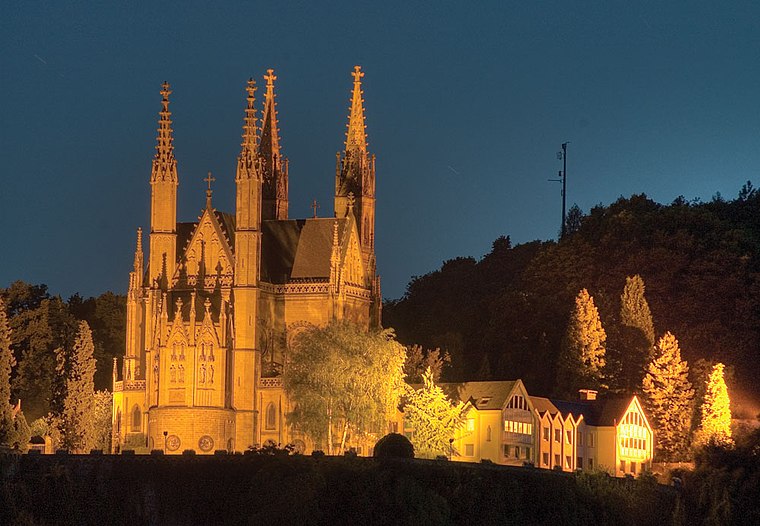
Photo: IllusionFactory, CC BY-SA 3.0.
The Apollinariskirche is a church on the site of a Roman temple on the Apollinarisberg, a hill above the German town of Remagen. That hill was known as the Martinsberg in the 5th and 6th centuries, presumably after a Frankish chapel there dedicated to Saint Martin, patron of the Franks. Apollinariskirche is situated 2½ km northeast of Straußenfarm Gemarkenhof.
St. Lambertus (Kirchdaun)
Church

Photo: Reinhardhauke, CC BY-SA 3.0.
St. Lambertus (Kirchdaun) is a church, which is situated 1½ km west of Straußenfarm Gemarkenhof.
Schloss Marienfels
Castle
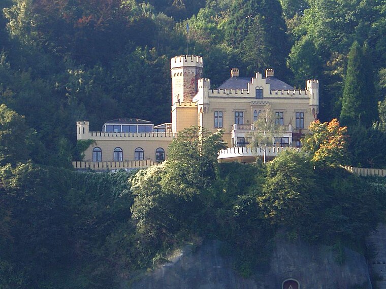
Photo: Tohma, CC BY-SA 4.0.
Schloss Marienfels is a castle, which is situated 2½ km northeast of Straußenfarm Gemarkenhof.
Places in the Area
Nearby places include Kirchdaun and Lohrsdorf.


Straußenfarm Gemarkenhof
Latitude
50.57194° or 50° 34′ 19″ northLongitude
7.18808° or 7° 11′ 17″ eastOpen location code
9F29H5CQ+Q6OpenStreetMap ID
way 299059806OpenStreetMap feature
building=yes
This page is based on OpenStreetMap, Wikidata, and Wikimedia Commons.
We’d love your help improving our open data sources. Thank you for contributing.
Satellite Map
Discover Straußenfarm Gemarkenhof from above in high-definition satellite imagery.
Notable Places Nearby
Highlights include Scheidskopf and Golfclub Bad Neuenahr-Ahrweiler.
Nearby Places
Explore places such as Zur Straußenfarm and Hofladen Straußenfarm.
Eifel: Must-Visit Destinations
Delve into Bitburg, Mayen, Nürburg, and Dernau.
Curious Buildings to Discover
Uncover intriguing buildings from every corner of the globe.
About Mapcarta. Data © OpenStreetMap contributors and available under the Open Database License". Text is available under the CC BY-SA 4.0 license, except for photos, directions, and the map. Photo: Thilver, CC BY-SA 4.0.