The Grange
The Grange is a farm in St. Peter, South Elmham, Waveney District, England. The Grange is situated nearby to the hamlet St Peter South Elmham, as well as near Church of St Peter.| Tap on a place to explore it |
Places of Interest Nearby
Highlights include Church of St Peter and Church of St Margaret.
Church of St Peter
Church

Photo: Bob Jones, CC BY-SA 2.0.
Church of St Peter is situated 2,400 feet east of The Grange.
Church of St Margaret
Church

Photo: Andrew Hill, CC BY-SA 2.0.
Church of St Margaret is situated 1 mile southwest of The Grange.
All Saints Church, South Elmham
Church
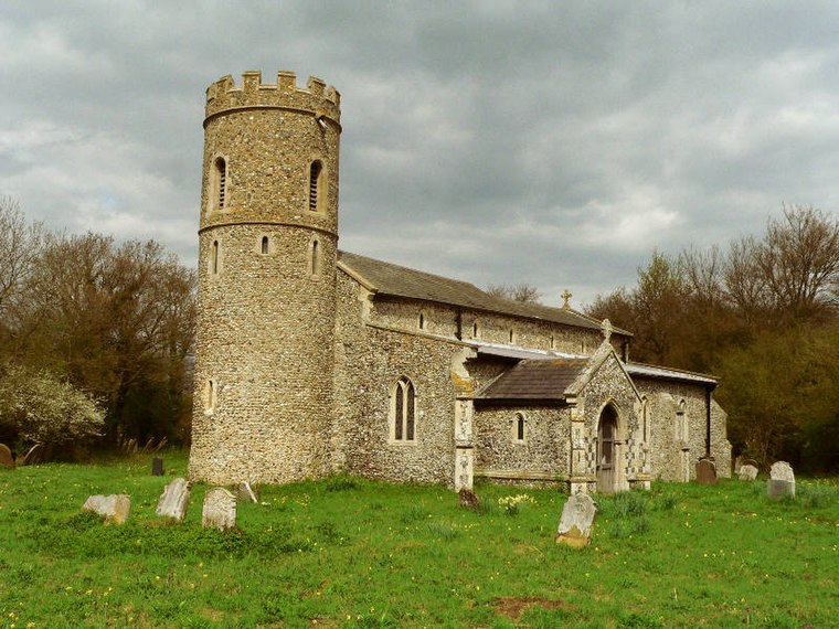
Photo: Pommes104, CC BY-SA 3.0.
All Saints Church is a redundant Anglican church in the village of All Saints' South Elmham, one of a group of villages jointly known as The Saints, in Suffolk, England. All Saints Church, South Elmham is situated 1¼ miles south of The Grange.
Places in the Area
Nearby places include St Peter South Elmham and St Margaret South Elmham.
St Peter South Elmham
Hamlet
St Peter South Elmham is a village and civil parish in the north of the English county of Suffolk. It is around 3 miles south of the market town of Bungay in the East Suffolk district.
St Margaret South Elmham
Village
St Margaret South Elmham is a village and civil parish in the north of the English county of Suffolk. It is 4 miles south-west of the market town of Bungay in the East Suffolk district.
St Michael South Elmham
Village
St Michael South Elmham is a village and civil parish in the north of the English county of Suffolk. It is 4 miles south of the market town of Bungay in the East Suffolk district.
The Grange
- Type: Farm
- Category: agriculture
- Location: St. Peter, South Elmham, Waveney District, Suffolk, East of England, England, United Kingdom, Britain and Ireland, Europe
- View on OpenStreetMap
Latitude
52.41208° or 52° 24′ 44″ northLongitude
1.42265° or 1° 25′ 22″ eastOpen location code
9F43CC6F+R3OpenStreetMap ID
way 299202493OpenStreetMap feature
landuse=farmyard
This page is based on OpenStreetMap, Wikidata, and Wikimedia Commons.
We’d love your help improving our open data sources. Thank you for contributing.
Satellite Map
Discover The Grange from above in high-definition satellite imagery.
Places with the Same Name
Discover other places named “The Grange”.
Notable Places Nearby
Highlights include St Margret’s Green - Open Access Land and Saint Michael, South Elmham.
Nearby Places
Explore places such as Retreat Farm and St Peter’s Hall.
Suffolk: Must-Visit Destinations
Delve into Ipswich, Bury St Edmunds, Lowestoft, and Felixstowe.
Curious Farms to Discover
Uncover intriguing farms from every corner of the globe.
About Mapcarta. Data © OpenStreetMap contributors and available under the Open Database License". Text is available under the CC BY-SA 4.0 license, except for photos, directions, and the map. Photo: Wikimedia, CC0.