It Mienskar
It Mienskar is a community center in Waadhoeke, Friesland. It Mienskar is situated nearby to the village Oosterbierum, as well as near the church Sint-Joriskerk.| Tap on a place to explore it |
Places of Interest Nearby
Highlights include Sint-Joriskerk and Liauckamastate.
Sint-Joriskerk
Church
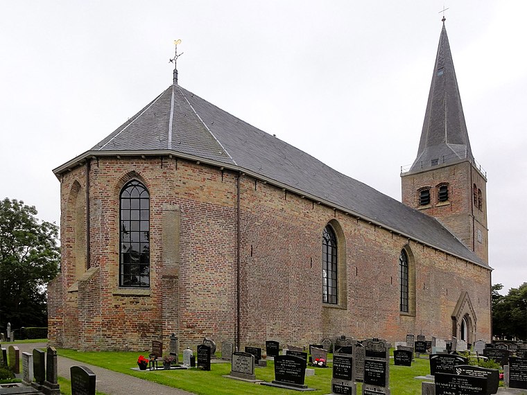 Sint-Joriskerk is a church, which is situated 130 metres south of It Mienskar.
Liauckamastate
Castle
 The Liauckamastate or Liauckama State is a former stins near the Dutch village of Sexbierum, Friesland. It was one of Friesland's biggest estates and was inhabited by members of the Liauckama family. Liauckamastate is situated 3 km southwest of It Mienskar.
Reformed Church Sexbierum
Church

Photo: Ziko, CC BY-SA 3.0.
Reformed Church Sexbierum is situated 2½ km southwest of It Mienskar.
Places in the Area
Nearby places include Oosterbierum and Klooster-Lidlum.
Oosterbierum
Village
 Oosterbierum is a village in Waadhoeke municipality in the province of Friesland, the Netherlands. It had a population of around 561 in January 2014.
Klooster-Lidlum
Hamlet

Photo: Wikimedia, CC BY-SA 4.0.
Klooster-Lidlum is a small village in Waadhoeke municipality in the province of Friesland, the Netherlands. It had a population of around 38 in January 2014.
Tzummarum
Village

Photo: Michielverbeek, CC BY-SA 3.0.
Tzummarum is a village in Waadhoeke municipality in the province of Friesland, the Netherlands. It had a population of around 1,414 in January 2014.
It Mienskar
- Type: Community center
- Category: building
- Location: Waadhoeke, Friesland, Northern Netherlands, Netherlands, Benelux, Europe
- View on OpenStreetMap
Latitude
53.23506° or 53° 14′ 6″ northLongitude
5.51134° or 5° 30′ 41″ eastInception
1975Open location code
9F576GP6+2GOpenStreetMap ID
way 302330534OpenStreetMap feature
amenity=community_centreOpenStreetMap feature
building=yes
This page is based on OpenStreetMap, Wikidata, and Wikimedia Commons.
We’d love your help improving our open data sources. Thank you for contributing.
Satellite Map
Discover It Mienskar from above in high-definition satellite imagery.
Notable Places Nearby
Highlights include De Hege Wier and De Korenaar.
Nearby Places
Explore places such as Keatsebuorren and De Kraak van van Dam.
Friesland: Must-Visit Destinations
Delve into Leeuwarden, Heerenveen, Sneek, and Harlingen.
Curious Community Centers to Discover
Uncover intriguing community centers from every corner of the globe.
About Mapcarta. Data © OpenStreetMap contributors and available under the Open Database License". Text is available under the CC BY-SA 4.0 license, except for photos, directions, and the map. Photo: WiDi, CC BY-SA 3.0.