São Judas Unimonte
São Judas Unimonte is an university in Santos and South Coast, São Paulo which is located on Rua Comendador Martins. São Judas Unimonte is situated nearby to the college FATEC Rubens Lara, as well as near ETEC Dona Escolástica Rosa.| Tap on a place to explore it |
Places of Interest Nearby
Highlights include Monte Serrat and Estádio Urbano Caldeira.

Estádio Urbano Caldeira
Stadium

Photo: BrazilianDude70, CC BY-SA 4.0.
The Estádio Urbano Caldeira, most known as Vila Belmiro, is an association football stadium in Santos, Brazil, Located in the Vila Belmiro neighborhood, it is home of Santos. Estádio Urbano Caldeira is situated 1¼ km southwest of São Judas Unimonte.
Arena Santos
Sports venue
Arena Santos is an indoor sporting arena located in Santos in São Paulo, Brazil, used for table tennis. The seating capacity of the arena is 5,000 people, and it was opened on 27 October 2010. Arena Santos is situated 550 metres west of São Judas Unimonte.
Places in the Area
Nearby places include Centro and Santos.
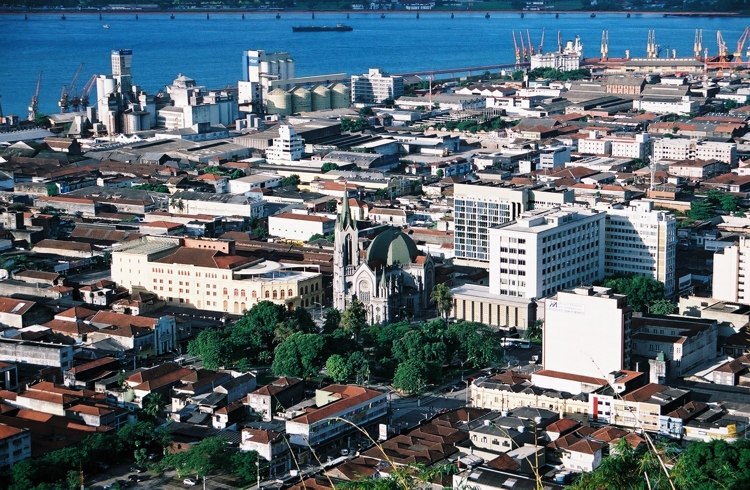
Santos

Photo: Wikimedia, CC BY-SA 2.0.
Santos is a city in the south of the state of São Paulo, Brazil. Santos is the core city of Baixada Santista, a coastal metropolitan area, and contains the most important port in South America.
Ponta da Praia
Suburb
 Ponta da Praia is a suburb, which is situated 5 km southeast of São Judas Unimonte.
São Judas Unimonte
- Type: University
- Address: 52 Rua Comendador Martins, Vila Mathias, Santos, 11015-530
- Category: education
- Location: Santos and South Coast, São Paulo, Southeast, Brazil, South America
- View on OpenStreetMap
Latitude
-23.94379° or 23° 56′ 38″ southLongitude
-46.32812° or 46° 19′ 41″ westOpen location code
588M3M4C+FQOpenStreetMap ID
way 305498733OpenStreetMap feature
amenity=university
This page is based on OpenStreetMap, Wikidata, and Wikimedia Commons.
We’d love your help improving our open data sources. Thank you for contributing.
Satellite Map
Discover São Judas Unimonte from above in high-definition satellite imagery.
Notable Places Nearby
Highlights include FATEC Rubens Lara and ETEC Dona Escolástica Rosa.
Nearby Places
Explore places such as Bike Santos (Estação 19) and Moveltec - Móveis para Escritório.
Santos and South Coast: Must-Visit Destinations
Delve into Santos, Guarujá, São Vicente, and Cubatão.
Curious Places to Discover
Uncover intriguing places from every corner of the globe.
About Mapcarta. Data © OpenStreetMap contributors and available under the Open Database License". Text is available under the CC BY-SA 4.0 license, except for photos, directions, and the map. Photo: Wikimedia, CC0.