Rock windbreak
Rock windbreak is a shelter in San Bernardino County, Southern California, California. Rock windbreak is situated nearby to the peak Mount San Antonio, as well as near West Baldy.| Tap on a place to explore it |
Places of Interest Nearby
Highlights include Mount San Antonio and Mount Harwood.
Mount San Antonio
Peak
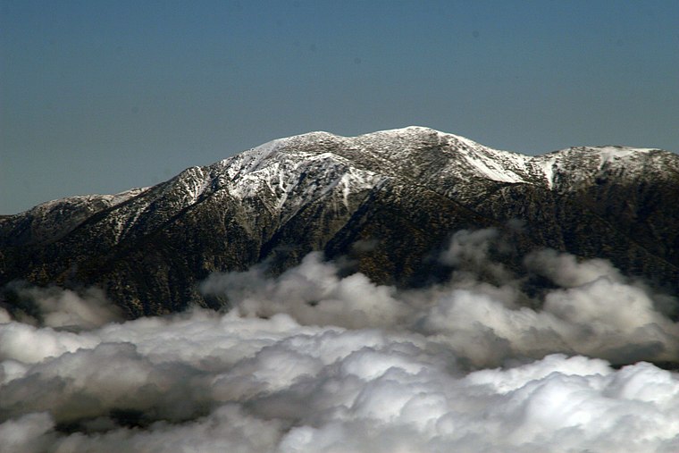
Photo: Tillman, CC BY-SA 2.0.
Mount San Antonio, commonly referred to as Mount Baldy or Old Baldy, is a 10,064 ft summit in the San Gabriel Mountains on the border of Los Angeles and San Bernardino counties of California.
Mount Harwood
Peak
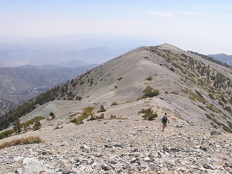
Photo: Justin.Johnsen, CC BY 2.5.
Mount Harwood is the first summit east of Mount San Antonio. The United States Geological Survey recognized the name to honor California educator and conservationist Aurelia Squire Harwood in 1965.
Places in the Area
Nearby places include Mount Baldy School District and Wrightwood.
Mount Baldy School District
Village
 The Mt Baldy School District consists of one school, Mt Baldy School, that serves students in grades K-8 in Mount Baldy, California, USA. Mount Baldy School District is situated 3½ miles south of Rock windbreak.
Wrightwood
Town

Photo: Jamesb01, CC BY-SA 3.0.
Wrightwood is a census-designated place in San Bernardino County, California. It sits at an elevation of 6,208 feet. The population was 4,720 at the 2020 census, up from 4,525 at the 2010 census. Wrightwood is situated 5 miles north of Rock windbreak.
Rock windbreak
Latitude
34.28907° or 34° 17′ 21″ northLongitude
-117.64653° or 117° 38′ 48″ westOpen location code
856479Q3+J9OpenStreetMap ID
way 310273432OpenStreetMap feature
amenity=shelter
This page is based on OpenStreetMap, Wikidata, and Wikimedia Commons.
We’d love your help improving our open data sources. Thank you for contributing.
Satellite Map
Discover Rock windbreak from above in high-definition satellite imagery.
Notable Places Nearby
Highlights include West Baldy and Gold Ridge Mine.
Nearby Places
Explore places such as Rock windbreak and Baldy Bowl Tr..
San Bernardino County: Must-Visit Destinations
Delve into San Bernardino, Fontana, Ontario, and Victorville.
Curious Shelters to Discover
Uncover intriguing shelters from every corner of the globe.
About Mapcarta. Data © OpenStreetMap contributors and available under the Open Database License". Text is available under the CC BY-SA 4.0 license, except for photos, directions, and the map. Photo: Wikimedia, CC0.