Deano’s
Deano’s is a fast food restaurant in Coventry, England which is located on Queen Isabels Avenue. Deano’s is situated nearby to the suburb Cheylesmore, as well as near Quinton Park Baptist Church.| Tap on a place to explore it |
- Type: Fast food restaurant
- Cuisine: fish and chips
- Address: 7 Queen Isabels Avenue, Coventry, CV3 5GE
Places of Interest Nearby
Highlights include Coventry railway station and Coventry Cathedral.
Coventry railway station
Railway station
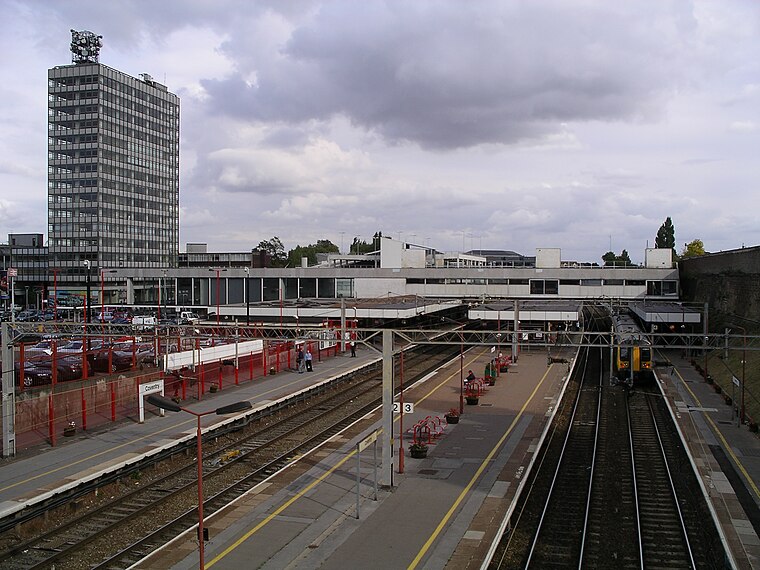
Photo: Snowmanradio, CC BY-SA 3.0.
Coventry railway station serves the city of Coventry, in the West Midlands, England. It lies on the Birmingham loop of the West Coast Main Line; it is also located at the centre of a junction where the lines to Nuneaton and to Leamington converge. Coventry railway station is situated 3,100 feet northwest of Deano’s.
Coventry Cathedral
Church

Photo: DeFacto, CC BY-SA 4.0.
The Cathedral Church of Saint Michael, commonly known as Coventry Cathedral, is the seat of the Bishop of Coventry and the Diocese of Coventry within the Church of England. Coventry Cathedral is situated 1 mile north of Deano’s.
London Road Cemetery
Cemetery

Photo: Robin Stott, CC BY-SA 2.0.
London Road Cemetery is a 17-hectare cemetery in Coventry, England, designed by Joseph Paxton and opened in 1847. It lies southeast of the city centre and is bisected by the West Coast main railway line between Coventry and Rugby, which pre-dates the cemetery and runs roughly west–east through it. London Road Cemetery is situated 1,500 feet northeast of Deano’s.
Places in the Area
Nearby places include Cheylesmore and Stivichall.
Cheylesmore
Suburb

Photo: Snowmanradio, CC BY-SA 3.0.
Cheylesmore is a suburb in the southern half of the city of Coventry, West Midlands, England. It is one of Coventry's largest suburbs, sharing borders with Whitley and Stivichall in the South, extending into Coventry city centre and bordering with Earlsdon in the North.
Stivichall
Suburb
Stivichall or Styvechale is a suburb of the city of Coventry, in the county of the West Midlands, England. It is a mainly residential area in the south of the city.
Spon End
Suburb
Spon End is a suburb of Coventry, England. It is situated west of Coventry city centre. The Butts Park Arena and a Premier Inn hotel are situated on the main road through Spon End.
Deano’s
- Categories: building, retail building, food, and restaurant
- Location: Coventry, England, United Kingdom, Britain and Ireland, Europe
- View on OpenStreetMap
Latitude
52.39456° or 52° 23′ 40″ northLongitude
-1.50426° or 1° 30′ 15″ westLevels
3Open location code
9C4W9FVW+R7OpenStreetMap ID
way 310503287OpenStreetMap feature
amenity=fast_foodOpenStreetMap feature
building=retailOpenStreetMap attribute
cuisine=fish_and_chips
This page is based on OpenStreetMap, Wikidata, and Wikimedia Commons.
We’d love your help improving our open data sources. Thank you for contributing.
Satellite Map
Discover Deano’s from above in high-definition satellite imagery.
Places with the Same Name
Discover other places named “Deano’s”.
Notable Places Nearby
Highlights include Cheylesmore Social Club and Quinton Park Baptist Church.
Nearby Places
Explore places such as Daisy’s and Prominence Estates.
England: Must-Visit Destinations
Delve into London, Manchester, Sheffield, and Leeds.
Curious Fast Food Restaurants to Discover
Uncover intriguing fast food restaurants from every corner of the globe.
About Mapcarta. Data © OpenStreetMap contributors and available under the Open Database License". Text is available under the CC BY-SA 4.0 license, except for photos, directions, and the map. Photo: Mintchocicecream, CC0.