Magnuson Building
Magnuson Building is a school building in Spokane, Washington which is located on West Whistalks Way. Magnuson Building is situated nearby to EOS Planetarium, as well as near Library.| Tap on a place to explore it |
Places of Interest Nearby
Highlights include Northwest Museum of Arts and Culture and Spokane County Courthouse.
Northwest Museum of Arts and Culture
Museum
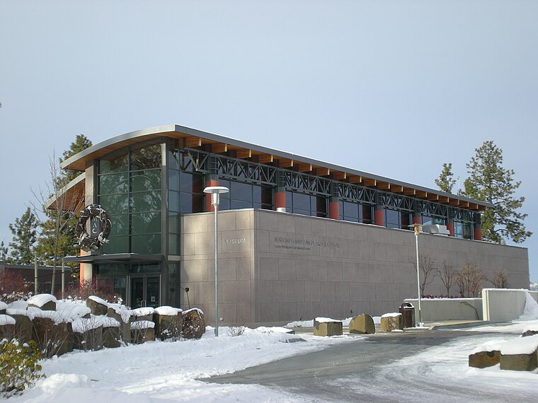
Photo: Murderbike, Public domain.
The Northwest Museum of Arts and Culture, formerly the Cheney Cowles Museum, is located in Spokane, Washington's Browne's Addition neighborhood. It is associated with the Smithsonian Institution, and is accredited by the American Alliance of Museums. Northwest Museum of Arts and Culture is situated 1½ miles south of Magnuson Building.
Spokane County Courthouse
Courthouse
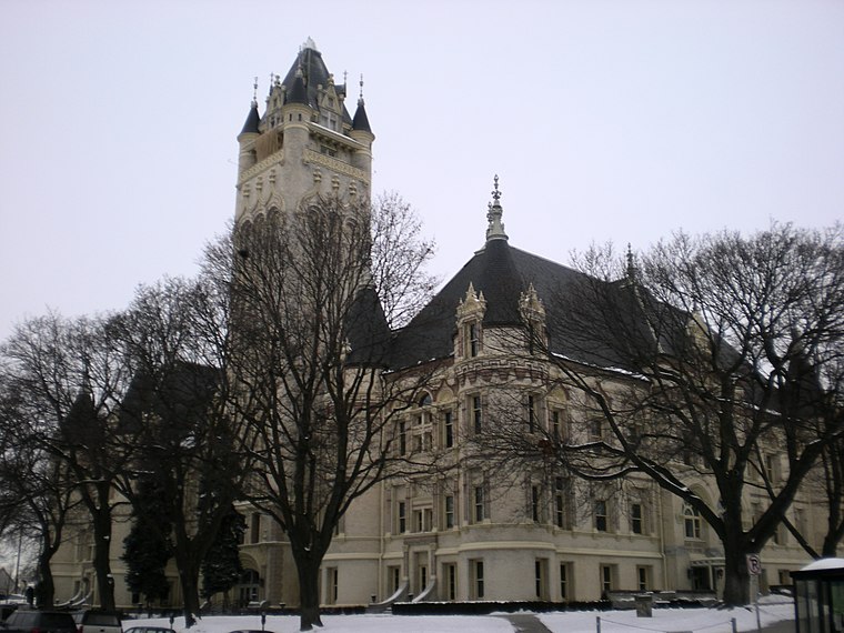
Photo: Murderbike, Public domain.
The Spokane County Courthouse is a government building home to numerous Spokane County offices such as those of the assessor, auditor and clerk, as well as courtrooms for the Spokane County Superior Court. Spokane County Courthouse is situated 1½ miles southeast of Magnuson Building.
One Spokane Stadium
Stadium
One Spokane Stadium is a multi-use stadium in downtown Spokane, Washington, United States. It is home to the professional soccer teams Spokane Velocity of USL League One and Spokane Zephyr FC of the USL Super League and USL W League, as well as Spokane Public Schools high school teams in several sports. One Spokane Stadium is situated 2 miles east of Magnuson Building.
Places in the Area
Nearby places include West Central and Peaceful Valley.
West Central
Quarter
West Central is a neighborhood in Spokane, Washington. As the name suggests it is located centrally on the west side of the city. Downtown Spokane is immediately east of the neighborhood, and spreads into West Central along Monroe Street in the Kendall Yards area.
Peaceful Valley
Quarter
Peaceful Valley is a neighborhood in Spokane, Washington. It sits directly below Downtown Spokane on the Spokane River under its falls. The neighborhood snakes along the thin floodplain on the valley floor of the Spokane River Gorge.
Browne’s Addition
Quarter
Browne's Addition, often referred to shorthand as just Browne's, is a neighborhood in Spokane, Washington. It is located directly west of Downtown Spokane and is one of the oldest and densest neighborhoods in the city. Browne’s Addition is situated 1½ miles southeast of Magnuson Building.
Magnuson Building
- Type: School building
- Address: 2917 West Whistalks Way, Spokane, WA 99224
- Categories: building and education
- Location: Spokane, Washington, Pacific Northwest, United States, North America
- View on OpenStreetMap
Latitude
47.67609° or 47° 40′ 34″ northLongitude
-117.45699° or 117° 27′ 25″ westLevels
2Operator
Spokane Falls Community CollegeOpen location code
85V4MGGV+C6OpenStreetMap ID
way 310856128OpenStreetMap feature
building=school
This page is based on OpenStreetMap, Wikidata, and Wikimedia Commons.
We’d love your help improving our open data sources. Thank you for contributing.
Satellite Map
Discover Magnuson Building from above in high-definition satellite imagery.
Notable Places Nearby
Highlights include EOS Planetarium and Library.
Nearby Places
Explore places such as TJ Meenach @ Elliot and Whistalks Way @ Elliot Drive.
Washington: Must-Visit Destinations
Delve into Seattle, Olympia, Tacoma, and Spokane.
Curious Schools to Discover
Uncover intriguing schools from every corner of the globe.
About Mapcarta. Data © OpenStreetMap contributors and available under the Open Database License". Text is available under the CC BY-SA 4.0 license, except for photos, directions, and the map. Photo: Lumpytrout, CC BY-SA 3.0.