L
L is a residential area in Godoy Cruz Department, Mendoza. L is situated nearby to the college CCT 6-012 Rosario Vera Peñaloza, as well as near the sports venue Polideportivo Minicipal Gobernador Santiago Felipe Llaver.| Tap on a place to explore it |
Places of Interest Nearby
Highlights include Estadio Feliciano Gambarte and San Martín station.
Estadio Feliciano Gambarte
Stadium

Photo: Feliciano 1921, CC0.
Estadio Feliciano Gambarte, nicknamed La Bodega, is a stadium in Godoy Cruz, Mendoza, Argentina. It is used primarily for football matches and is owned and operated by Godoy Cruz Antonio Tomba. Estadio Feliciano Gambarte is situated 3 km northeast of L.
San Martín station
Railway stop

Photo: Mauricio V. Genta, CC BY-SA 4.0.
Parador San Martín is a light rail station located on the intersection of Calle Anzorena and Avenida San Martín in Godoy Cruz, Godoy Cruz Department, Mendoza Province, Argentina. It opened in 2012, as part of the first section of the Metrotranvía Mendoza… San Martín station is situated 2½ km northeast of L.
Godoy Cruz railway station
Railway stop
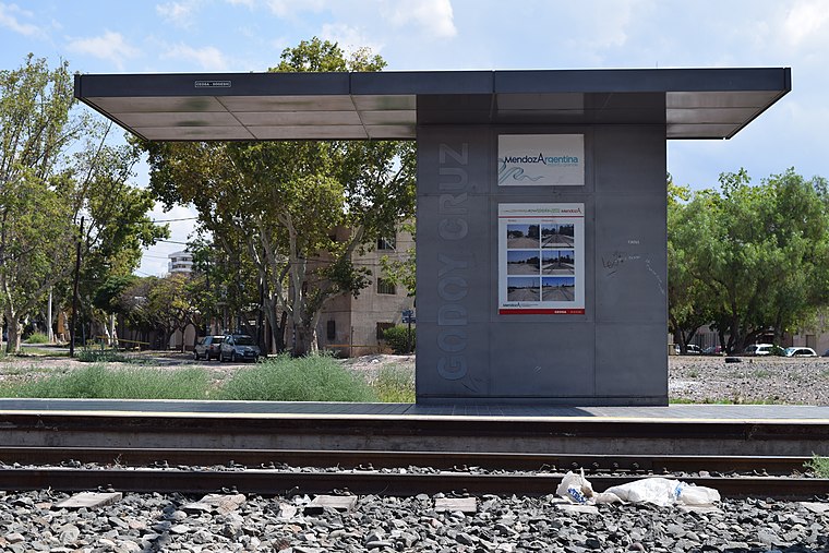
Photo: Mauricio V. Genta, CC BY-SA 4.0.
Godoy Cruz is a light rail station and former railway station in the city of Godoy Cruz, in the department of the same name in Mendoza Province, Argentina. Godoy Cruz railway station is situated 3 km northeast of L.
Places in the Area
Nearby places include Mendoza and Luzuriaga.
Mendoza

Photo: Wikimedia, CC BY-SA 3.0.
Mendoza is a city in western Argentina, in the desert Cuyo region. Mendoza is the center of the Argentinian wine industry, for which it is world renowned.

Chacras de Coria
Town
Chacras de Coria is a small town located in an oasis in the north of the province of Mendoza, Argentina, a few kilometers from the capital city. Due to its characteristics of a micro-climate during summer months, the area is popular for recreation. Chacras de Coria is situated 6 km south of L.
L
- Type: Residential area
- Location: Godoy Cruz Department, Mendoza, Cuyo, Argentina, South America
- View on OpenStreetMap
Latitude
-32.93463° or 32° 56′ 5″ southLongitude
-68.86509° or 68° 51′ 54″ westOpen location code
47VH348M+5XOpenStreetMap ID
way 315692317OpenStreetMap feature
landuse=residential
This page is based on OpenStreetMap, Wikidata, and Wikimedia Commons.
We’d love your help improving our open data sources. Thank you for contributing.
Satellite Map
Discover L from above in high-definition satellite imagery.
Notable Places Nearby
Highlights include CCT 6-012 Rosario Vera Peñaloza and Polideportivo Minicipal Gobernador Santiago Felipe Llaver.
Nearby Places
Explore places such as Escuela 1-698 Provincia de Mendoza and Escuela 1-712 Maestro Jesús de Nazaret.
Mendoza: Must-Visit Destinations
Delve into Aconcagua, Mendoza, San Rafael, and Malargüe.
Curious Residential Areas to Discover
Uncover intriguing residential areas from every corner of the globe.
About Mapcarta. Data © OpenStreetMap contributors and available under the Open Database License". Text is available under the CC BY-SA 4.0 license, except for photos, directions, and the map. Photo: Wikimedia, CC BY-SA 3.0.