Autal I
Autal I is an allotment garden in Wedel, Pinneberg, Schleswig-Holstein. Autal I is situated nearby to the playground Op’n Klint, as well as near the church Neuapostolische Kirche Wedel.| Tap on a place to explore it |
Places of Interest Nearby
Highlights include Wedel station and Stadtmuseum Wedel.
Wedel station
Railway station

Photo: Rmw73, CC BY-SA 3.0.
Wedel station is a railway station on the Altona-Blankenese line, served by the rapid transit trains of the Hamburg S-Bahn, located in Wedel, Germany. It is a terminus of the line S1. Wedel station is situated 590 metres southwest of Autal I.
Stadtmuseum Wedel
Museum

Photo: Bullenwächter, CC BY-SA 3.0.
Stadtmuseum Wedel is situated 1 km west of Autal I.
Theaterschiff Batavia
Theater building
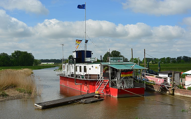 Theaterschiff Batavia is a theater building, which is situated 1¼ km west of Autal I.
Places in the Area
Nearby places include Rissen and Holm.
Rissen
Suburb

Photo: Rmw73, CC BY-SA 3.0.
Rissen is a quarter of the city of Hamburg in Germany. It is located in the borough of Altona and is the westernmost quarter of Hamburg, bordering the German federal state of Schleswig-Holstein in the west, north, and northeast and the Elbe river to the south. Rissen is situated 3 km east of Autal I.
Holm
Village
 Holm is a municipality in the district of Pinneberg, in Schleswig-Holstein, Germany. It is part of the Amt Geest und Marsch Südholstein. In the eastern part is the local recreation area Holmer Sandberge, to the west of Holm begins the Elbmarsch. Holm is situated 4½ km northwest of Autal I.
Borstel
Village

Photo: Tiefflieger, CC BY-SA 2.5.
Borstel is a village, which is situated 5 km south of Autal I.
Autal I
- Type: Allotment garden
- Location: Wedel, Pinneberg, South Holstein, Schleswig-Holstein, Germany, Central Europe, Europe
- View on OpenStreetMap
Latitude
53.5855° or 53° 35′ 8″ northLongitude
9.71229° or 9° 42′ 44″ eastOpen location code
9F5FHPP6+5WOpenStreetMap ID
way 31955097OpenStreetMap feature
landuse=allotments
This page is based on OpenStreetMap, Wikidata, and Wikimedia Commons.
We’d love your help improving our open data sources. Thank you for contributing.
Satellite Map
Discover Autal I from above in high-definition satellite imagery.
Notable Places Nearby
Highlights include Op’n Klint and Autal.
Nearby Places
Explore places such as Autal II and Pestalozzi-Schule.
South Holstein: Must-Visit Destinations
Delve into Neumünster, Itzehoe, Glückstadt, and Bad Segeberg.
Curious Allotment Gardens to Discover
Uncover intriguing allotment gardens from every corner of the globe.
About Mapcarta. Data © OpenStreetMap contributors and available under the Open Database License". Text is available under the CC BY-SA 4.0 license, except for photos, directions, and the map. Photo: HP-WEDEL, CC BY-SA 4.0.