The Newhampton
The Newhampton is a pub in Wolverhampton, England which is located on Riches Street. The Newhampton is situated nearby to the pitch Tettenhall-Newhampton Crown Green Bowling Club, as well as near Cranmer Methodist Church.| Tap on a place to explore it |
Places of Interest Nearby
Highlights include Molineux Stadium and Church of St Jude.
Molineux Stadium
Stadium
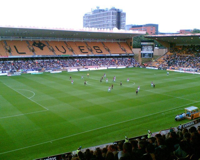
Photo: John Nickolls, CC BY-SA 2.0.
Molineux Stadium is a football stadium situated in Wolverhampton, West Midlands, England. It has been the home ground of Premier League club Wolverhampton Wanderers since 1889. Molineux Stadium is situated 1 mile east of The Newhampton.
Church of St Jude
Church

Photo: Brianboru100, CC BY-SA 4.0.
Church of St Jude is situated 780 feet southwest of The Newhampton.
West Park
Park

Photo: Martyn B, CC BY-SA 2.0.
Formerly called the People's Park, Wolverhampton's West Park was opened on 6 June 1881. It is Grade II* listed in Historic England's Register of Parks and Gardens. West Park is situated 2,700 feet southeast of The Newhampton.
Places in the Area
Nearby places include Aldersley and Claregate.
Aldersley
Quarter
Aldersley is a suburb of Wolverhampton, West Midlands, England. It is north-west of Wolverhampton city centre, within the Tettenhall Regis ward. Aldersley is a relatively modern part of Wolverhampton, with most of the housing stock – both private and council – dating from after World War II.
Claregate
Neighborhood
Claregate is a suburb of Wolverhampton, West Midlands, England. It is north west of Wolverhampton city centre, within the Tettenhall Regis ward.
Springfield
Quarter

Photo: John M, CC BY-SA 2.0.
Springfield is an area of Wolverhampton, England immediately north east of the city centre. It was the home of the Springfield Brewery from 1873 until 1991.
The Newhampton
- Type: Pub
- Address: 19 Riches Street, Wolverhampton, WV6 0DW
- Category: building
- Location: Wolverhampton, England, United Kingdom, Britain and Ireland, Europe
- View on OpenStreetMap
Latitude
52.59391° or 52° 35′ 38″ northLongitude
-2.14998° or 2° 8′ 60″ westOperator
Stonegate Pub CompanyOpen location code
9C4VHVV2+H2OpenStreetMap ID
way 319995912OpenStreetMap feature
amenity=pubOpenStreetMap feature
building=pub
This page is based on OpenStreetMap, Wikidata, and Wikimedia Commons.
We’d love your help improving our open data sources. Thank you for contributing.
Satellite Map
Discover The Newhampton from above in high-definition satellite imagery.
Notable Places Nearby
Highlights include Tettenhall-Newhampton Crown Green Bowling Club and Cranmer Methodist Church.
Nearby Places
Explore places such as Emotions Cards & Gifts and JR Interiors.
England: Must-Visit Destinations
Delve into London, Manchester, Sheffield, and Leeds.
Curious Pubs to Discover
Uncover intriguing pubs from every corner of the globe.
About Mapcarta. Data © OpenStreetMap contributors and available under the Open Database License". Text is available under the CC BY-SA 4.0 license, except for photos, directions, and the map. Photo: Mariegriffiths, CC BY-SA 4.0.