Flugkontrolle Bitburg
Flugkontrolle Bitburg is a tower in Röhl, Bitburg-Prüm, Rhineland-Palatinate. Flugkontrolle Bitburg is situated nearby to Gokartstrecke, as well as near the aerodrome Bitburg Airport.| Tap on a place to explore it |
Places of Interest Nearby
Highlights include Bitburg Airport and Streuobstwiesen und Hecken am Muenchensberg bei Huettingen.
Bitburg Airport
Aerodrome

Photo: Carsten Steger, CC BY-SA 4.0.
Bitburg Airport is a commercial airport serving Bitburg, a city in the Rhineland-Palatinate state of Germany. It is located 2 miles southeast of Bitburg, 32 km north of Trier, and 217 km west of Wiesbaden.
Streuobstwiesen und Hecken am Muenchensberg bei Huettingen
Nature reserve

Photo: Colling-architektur, CC BY-SA 3.0.
Streuobstwiesen und Hecken am Muenchensberg bei Huettingen is a nature reserve, which is situated 3 km northeast of Flugkontrolle Bitburg.
St. Petrus
Church
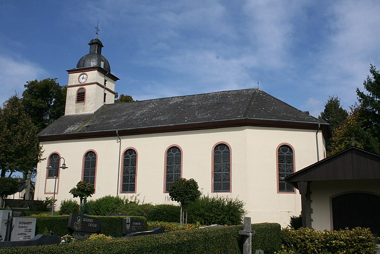
Photo: Weides Reinhard, Copyrighted free use.
St. Petrus is a church, which is situated 3 km south of Flugkontrolle Bitburg.
Places in the Area
Nearby places include Scharfbillig and Mötsch.
Scharfbillig
Village

Photo: Michielverbeek, CC BY-SA 4.0.
Scharfbillig is a municipality in the district of Bitburg-Prüm, in Rhineland-Palatinate, western Germany.

Sülm
Village
Photo: Weides Reinhard, Copyrighted free use.
Sülm is a municipality in the district of Bitburg-Prüm, in Rhineland-Palatinate, western Germany. Sülm is situated 3 km south of Flugkontrolle Bitburg.
Flugkontrolle Bitburg
- Type: Tower
- Location: Röhl, Bitburg-Prüm, Rhineland-Palatinate, Germany, Central Europe, Europe
- View on OpenStreetMap
Latitude
49.94573° or 49° 56′ 45″ northLongitude
6.55822° or 6° 33′ 30″ eastOpen location code
8FX8WHW5+77OpenStreetMap ID
way 320963180OpenStreetMap feature
man_made=tower
This page is based on OpenStreetMap, Wikidata, and Wikimedia Commons.
We’d love your help improving our open data sources. Thank you for contributing.
Satellite Map
Discover Flugkontrolle Bitburg from above in high-definition satellite imagery.
Notable Places Nearby
Highlights include Gokartstrecke and Sportschule Bitburg.
Nearby Places
Explore places such as Tower Bistro and ISU.
Rhineland-Palatinate: Must-Visit Destinations
Delve into Mainz, Trier, Koblenz, and Worms.
Curious Towers to Discover
Uncover intriguing towers from every corner of the globe.
About Mapcarta. Data © OpenStreetMap contributors and available under the Open Database License". Text is available under the CC BY-SA 4.0 license, except for photos, directions, and the map. Photo: Traveler100, CC BY-SA 3.0.