South Street Community Garden
South Street Community Garden is a garden in Philadelphia, Philadelphia Region, Pennsylvania. South Street Community Garden is situated nearby to Church of the Crucifixion, as well as near the police station South Street Police Sub Station.| Tap on a place to explore it |
Places of Interest Nearby
Highlights include Independence Hall and Liberty Bell.
Independence Hall
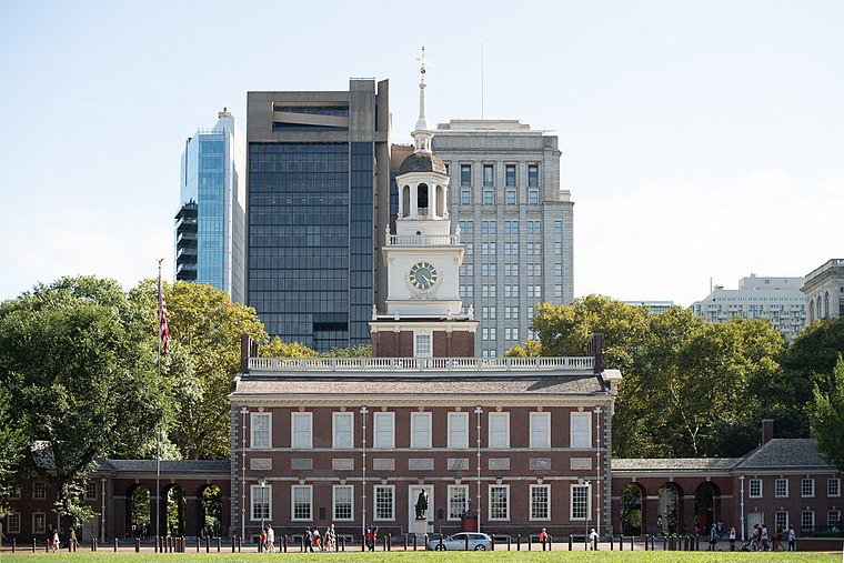
Photo: Mys 721tx, CC BY-SA 3.0.
Independence Hall is a historic civic building in Philadelphia, Pennsylvania, where both the Declaration of Independence and the Constitution of the United States were debated and adopted by the Founding Fathers of the United States. Independence Hall is situated 2,900 feet northeast of South Street Community Garden.
Liberty Bell

Photo: tonythemisfit, CC BY 2.0.
The Liberty Bell, previously called the State House Bell or Old State House Bell, is an iconic symbol of American independence located in Philadelphia. Liberty Bell is situated 3,000 feet northeast of South Street Community Garden.
Philadelphia’s Magic Gardens
Museum
 Philadelphia's Magic Gardens is a non-profit organization, folk art environment, and gallery space on South Street in Philadelphia, Pennsylvania. To date, it is the largest work created by mosaic artist Isaiah Zagar. Philadelphia’s Magic Gardens is situated 840 feet west of South Street Community Garden.
Places in the Area
Nearby places include Passyunk Square and Queen Village.
Passyunk Square
Neighborhood

Photo: Nick-philly, CC BY-SA 4.0.
Bella Vista, Italian for "beautiful sight", is a neighborhood in the South Philadelphia section of Philadelphia, Pennsylvania, United States. It is bounded by 6th Street, 11th Street, South Street and Washington Avenue. It currently has a population of 5,898.
Queen Village
Neighborhood

Photo: Beyond My Ken, CC BY-SA 4.0.
Queen Village is a residential neighborhood of Philadelphia, Pennsylvania, United States that lies along the eastern edge of the city in South Philadelphia.
Little Saigon
Neighborhood

Photo: Minormadam, CC BY 3.0.
One of the largest Vietnamese neighborhoods in the United States is Philadelphia's Little Saigon, located in Passyunk Square, a neighborhood in South Philadelphia.
South Street Community Garden
- Type: Garden
- Also known as: “South Street Garden”
- Category: recreation area
- Location: Philadelphia, Philadelphia, Philadelphia Region, Pennsylvania, Mid-Atlantic, United States, North America
- View on OpenStreetMap
Latitude
39.94274° or 39° 56′ 34″ northLongitude
-75.1564° or 75° 9′ 23″ westOpen location code
87F6WRVV+3COpenStreetMap ID
way 32121457OpenStreetMap feature
leisure=garden
This page is based on OpenStreetMap, Wikidata, and Wikimedia Commons.
We’d love your help improving our open data sources. Thank you for contributing.
Satellite Map
Discover South Street Community Garden from above in high-definition satellite imagery.
Notable Places Nearby
Highlights include Church of the Crucifixion and South Street Police Sub Station.
Nearby Places
Explore places such as Little Italy Pizza and Starbucks.
Philadelphia: Must-Visit Destinations
Delve into Philadelphia International Airport, Old City, West Philadelphia, and Center City West.
Curious Gardens to Discover
Uncover intriguing gardens from every corner of the globe.
About Mapcarta. Data © OpenStreetMap contributors and available under the Open Database License". Text is available under the CC BY-SA 4.0 license, except for photos, directions, and the map. Photo: Dave Z, CC BY 2.0.