Nassauer Kanu Club
Nassauer Kanu Club is a building in Nassau, Rhein-Lahn-Kreis, Rhineland-Palatinate which is located on Furth. Nassauer Kanu Club is situated nearby to the motorhome stopover Wohnmobilstellplatz Nassau, as well as near the water park Freibad Nassau.| Tap on a place to explore it |
Places of Interest Nearby
Highlights include Stein’s chateau and Nassau (Lahn).
Stein’s chateau
Castle
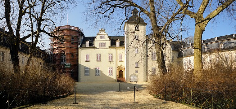
Photo: Hans G. Oberlack, CC BY-SA 4.0.
Stein’s chateau is a castle, which is situated 300 metres north of Nassauer Kanu Club.
Nassau (Lahn)
Railway station

Photo: Tohma, CC BY-SA 4.0.
Nassau (Lahn) is a railway station, which is situated 280 metres east of Nassauer Kanu Club.
Burg Stein
Castle
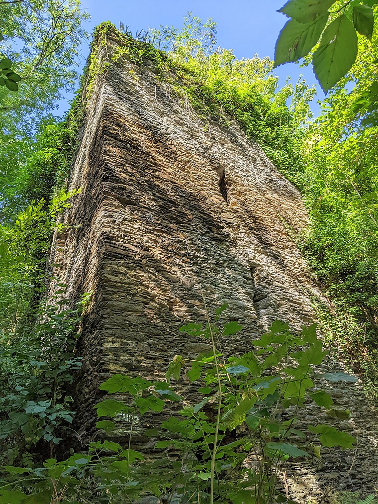
Photo: Tohma, CC BY-SA 4.0.
Burg Stein is a castle, which is situated 460 metres northwest of Nassauer Kanu Club.
Places in the Area
Nearby places include Nassau Castle and Dienethal.
Nassau Castle
Locality

Photo: Dysmachus, CC BY-SA 3.0.
Nassau Castle, located in Nassau, Rhineland-Palatinate, Germany and named after it, was a castle and the ancestrial seat of the House of Nassau and also its namesake, also it is the namesake of the historical Nassau realms of the County and Duchy of Nassau.
Dienethal
Village

Photo: LigaDue, CC BY-SA 4.0.
Dienethal is a municipality in the district of Rhein-Lahn, in Rhineland-Palatinate, in western Germany. It belongs to the association community of Bad Ems-Nassau.
Misselberg
Village

Photo: LigaDue, CC BY-SA 4.0.
Misselberg is a municipality in the district of Rhein-Lahn, in Rhineland-Palatinate, in western Germany. It belongs to the association community of Bad Ems-Nassau.
Nassauer Kanu Club
- Type: Canoe
- Address: Furth 2, Nassau, 56377
- Categories: building and sports location
- Location: Nassau, Rhein-Lahn-Kreis, North-East Rhineland-Palatinate, Rhineland-Palatinate, Germany, Central Europe, Europe
- View on OpenStreetMap
Latitude
50.31104° or 50° 18′ 40″ northLongitude
7.79692° or 7° 47′ 49″ eastOperator
NASSAUER KANU-CLUB 1950 e.V.Open location code
9F298Q6W+CQOpenStreetMap ID
way 323702538OpenStreetMap feature
building=yesOpenStreetMap feature
sport=canoe
This page is based on OpenStreetMap, Wikidata, and Wikimedia Commons.
We’d love your help improving our open data sources. Thank you for contributing.
Satellite Map
Discover Nassauer Kanu Club from above in high-definition satellite imagery.
Notable Places Nearby
Highlights include Wohnmobilstellplatz Nassau and Freibad Nassau.
Nearby Places
Explore places such as Charterboot Yasmin and Restaurant da Antonio.
North-East Rhineland-Palatinate: Must-Visit Destinations
Delve into Bad Ems, Montabaur, Lahnstein, and Katzenelnbogen.
Curious Places to Discover
Uncover intriguing places from every corner of the globe.
About Mapcarta. Data © OpenStreetMap contributors and available under the Open Database License". Text is available under the CC BY-SA 4.0 license, except for photos, directions, and the map. Photo: Wikimedia, CC0.