Bauhof des Wasserstraßen- und Schifffahrtsamtes Lübeck
Bauhof des Wasserstraßen- und Schifffahrtsamtes Lübeck is in Schleswig-Holstein, Germany. Bauhof des Wasserstraßen- und Schifffahrtsamtes Lübeck is situated nearby to the courthouse Amtsgericht Lübeck, as well as near the government office Landesbetrieb für Küstenschutz, Nationalpark und Meeresschutz Schleswig-Holstein.| Tap on a place to explore it |
Places of Interest Nearby
Highlights include St. Stephanus (Lübeck) and Burgtor Cemetery.
St. Stephanus (Lübeck)
Church

Photo: Nur Luis, CC BY-SA 4.0.
St. Stephanus (Lübeck) is a church, which is situated 790 metres southeast of Bauhof des Wasserstraßen- und Schifffahrtsamtes Lübeck.
Burgtor Cemetery
Cemetery

Photo: Wikimedia, CC BY-SA 3.0.
Burgtor Cemetery or Burgtorfriedhof, originally the Allgemeine Gottesacker, is the successor to other cemeteries in Burgtor, Lübeck suburb of St. Gertrud. Burgtor Cemetery is situated 1 km south of Bauhof des Wasserstraßen- und Schifffahrtsamtes Lübeck.
Brahms-Institut
Museum

Photo: 1970gemini, CC BY-SA 4.0.
Brahms-Institut acquired the largest private collection of Johannes Brahms engravings, manuscripts and first and early prints in 1990. In addition to Brahms, the focus is on Robert and Clara Schumann, Theodor Kirchner, Joseph Joachim, and some lesser known performers and composers of the era. Brahms-Institut is situated 1½ km south of Bauhof des Wasserstraßen- und Schifffahrtsamtes Lübeck.
Places in the Area
Nearby places include Israelsdorf and Lübeck.
Israelsdorf
Village

Photo: 1970gemini, CC BY-SA 3.0.
Israelsdorf is a village, which is situated 3 km east of Bauhof des Wasserstraßen- und Schifffahrtsamtes Lübeck.
Lübeck
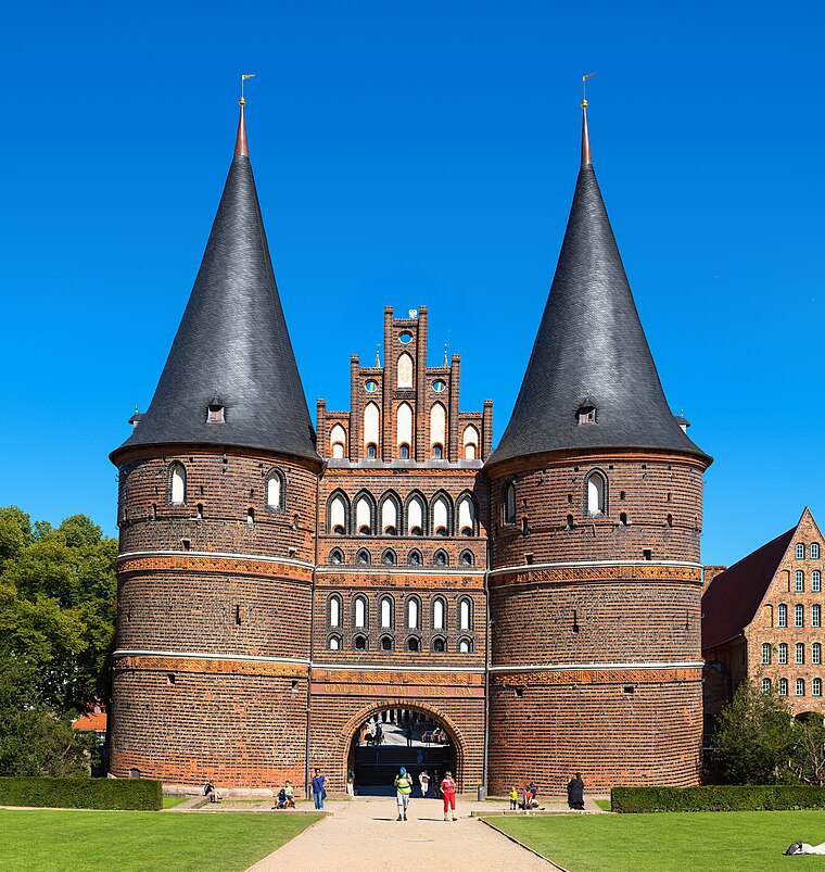
Photo: Dr. Chriss, CC BY-SA 3.0 de.
The Hanseatic City of Lübeck is the largest German port on the Baltic Sea and the second-largest city in Schleswig-Holstein, situated at the mouth of the river Trave.
Stockelsdorf
Town

Photo: Genet, CC BY-SA 3.0.
Stockelsdorf is a municipality in the district of Ostholstein, in Schleswig-Holstein, Germany. It is situated directly northwest of Lübeck and forms an agglomeration with the easterly town of Bad Schwartau. Stockelsdorf is situated 4 km west of Bauhof des Wasserstraßen- und Schifffahrtsamtes Lübeck.
Bauhof des Wasserstraßen- und Schifffahrtsamtes Lübeck
- Type: Brownfield land
- Category: industry
- Location: Schleswig-Holstein, Germany, Central Europe, Europe
- View on OpenStreetMap
Latitude
53.89431° or 53° 53′ 40″ northLongitude
10.704° or 10° 42′ 14″ eastOpen location code
9F5GVPV3+PJOpenStreetMap ID
way 325145410OpenStreetMap feature
landuse=brownfield
This page is based on OpenStreetMap, Wikidata, and Wikimedia Commons.
We’d love your help improving our open data sources. Thank you for contributing.
Satellite Map
Discover Bauhof des Wasserstraßen- und Schifffahrtsamtes Lübeck from above in high-definition satellite imagery.
Notable Places Nearby
Highlights include Amtsgericht Lübeck and Landesbetrieb für Küstenschutz, Nationalpark und Meeresschutz Schleswig-Holstein.
Nearby Places
Explore places such as Wasserstraßen und Schifffahrts amt Außenbezirk Lübeck Bauhof and Wasserstraßen Schiffahrtsamt Ostsee.
Schleswig-Holstein: Must-Visit Destinations
Delve into Kiel, Lübeck, Flensburg, and Heligoland.
Curious Places to Discover
Uncover intriguing places from every corner of the globe.
About Mapcarta. Data © OpenStreetMap contributors and available under the Open Database License". Text is available under the CC BY-SA 4.0 license, except for photos, directions, and the map. Photo: Ypsilon from Finland, CC0.