Edmonton Meat Packing
Edmonton Meat Packing is an industrial building in Edmonton, Edmonton Capital Region, Alberta. Edmonton Meat Packing is situated nearby to the church Edmonton Living Word Assembly, as well as near Evangelical Baptist Church.| Tap on a place to explore it |
Places of Interest Nearby
Highlights include Northlands Coliseum and Edmonton Expo Centre.
Northlands Coliseum
Stadium
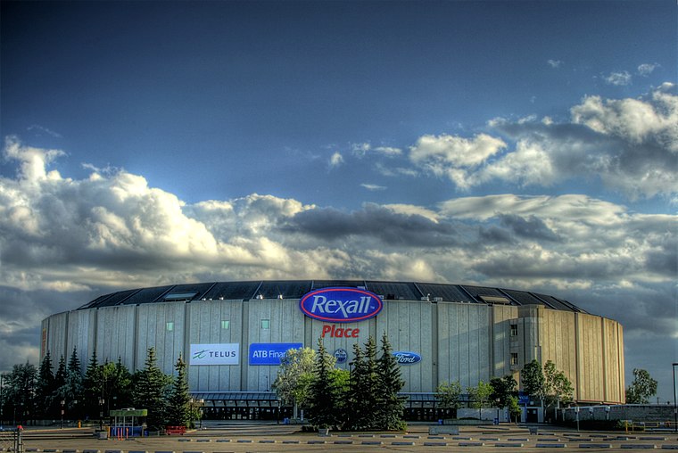
Photo: WinterE229, CC0.
Northlands Coliseum is a defunct indoor arena in Edmonton, Alberta. It was used for sports events and concerts, and was home to the Edmonton Oilers of the World Hockey Association and National Hockey League, and the Edmonton Oil Kings of the Western Hockey League. Northlands Coliseum is situated 1½ km southeast of Edmonton Meat Packing.
Edmonton Expo Centre
Convention center
 The Edmonton Expo Centre, formerly the Northlands AgriCom and also known as the Edmonton Exposition and Conference Centre is a multi-purpose convention centre in Edmonton, Alberta, Canada. Edmonton Expo Centre is situated 2 km southeast of Edmonton Meat Packing.
Coliseum station
Railway station
Coliseum station is an Edmonton LRT station in Edmonton, Alberta, Canada. It serves the Capital Line. It is located at 78 Street and 118 Avenue, near Northlands Coliseum, and is built on an overpass above 118 Avenue. Coliseum station is situated 1½ km southeast of Edmonton Meat Packing.
Places in the Area
Nearby places include Killarney and Balwin.
Killarney
Neighborhood
Killarney is a residential neighbourhood located in north east Edmonton, Alberta, Canada. While the area became part of Edmonton in 1913, residential development did not occur until the 1950s and 1960s.
Balwin
Neighborhood
Balwin is a residential neighbourhood in north east Edmonton, Alberta, Canada. Originally part of North Edmonton, the area was annexed by the City of Edmonton in 1912.
Glengarry
Neighborhood
Glengarry is a residential neighbourhood located in northeast Edmonton, Alberta, Canada. Northgate Centre is a major shopping mall in the neighbourhood's northwest corner.
Edmonton Meat Packing
- Type: Industrial building
- Categories: building and industry
- Location: Edmonton, Edmonton Capital Region, Alberta, Prairies, Canada, North America
- View on OpenStreetMap
Latitude
53.58289° or 53° 34′ 58″ northLongitude
-113.47029° or 113° 28′ 13″ westOpen location code
9558HGMH+5VOpenStreetMap ID
way 326394311OpenStreetMap feature
building=industrial
This page is based on OpenStreetMap, Wikidata, and Wikimedia Commons.
We’d love your help improving our open data sources. Thank you for contributing.
Satellite Map
Discover Edmonton Meat Packing from above in high-definition satellite imagery.
Notable Places Nearby
Highlights include Edmonton Living Word Assembly and Evangelical Baptist Church.
Nearby Places
Explore places such as Sokil Express Lines Ltd and Habitat for Humanity ReStore.
Edmonton: Must-Visit Destinations
Delve into Central Edmonton, South Central, South Edmonton, and North Edmonton.
Curious Industrial Buildings to Discover
Uncover intriguing industrial buildings from every corner of the globe.
About Mapcarta. Data © OpenStreetMap contributors and available under the Open Database License". Text is available under the CC BY-SA 4.0 license, except for photos, directions, and the map. Photo: WinterE229, CC0.