Chiefs Garden
Chiefs Garden is a sports venue in Neuss, Düsseldorf, North Rhine-Westphalia. Chiefs Garden is situated nearby to the sports venue Bezirkssportanlage Uedesheim, as well as near the pitch Kirmesplatz Uedesheim / Norfer Weg.| Tap on a place to explore it |
Places of Interest Nearby
Highlights include Friedenskirche and St. Martinus.
Friedenskirche
Church
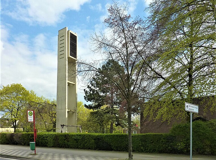
Photo: Chris06, CC BY-SA 4.0.
Friedenskirche is a church, which is situated 460 metres southeast of Chiefs Garden.
St. Martinus
Church

Photo: Chris06, CC BY-SA 4.0.
St. Martinus is a church, which is situated 1¼ km east of Chiefs Garden.
St. Nikolaus
Church

Photo: Chris06, Public domain.
St. Nikolaus is a church, which is situated 2 km east of Chiefs Garden.
Places in the Area
Nearby places include Himmelgeist and Düsseldorf-Itter.
Himmelgeist
Suburb
Himmelgeist is a quarter of Düsseldorf, part of Borough 9. It is an old village, which is dominated by agriculture until today. Himmelgeist lies by the river Rhine, neighbouring to Flehe and Itter.
Düsseldorf-Itter
Suburb
Itter is an urban quarter of Düsseldorf, part of Borough 9. It is located near to the river Rhine, adjacent to Himmelgeist, Holthausen and Reisholz. Its name comes from the small river called the Itter. Itter has an area of 2.58 km2, and 2,411 inhabitants. Düsseldorf-Itter is situated 3 km east of Chiefs Garden.
Flehe
Suburb
Flehe is a part of Düsseldorf, Germany, that lies directly on the river Rhine and is bordered by Volmerswerth, Himmelgeist and Bilk. It is part of Borough 3. Flehe is situated 3 km north of Chiefs Garden.
Chiefs Garden
- Type: Sports venue
- Categories: building, recreation area, and sports location
- Location: Neuss, Rhein-Kreis Neuss, Düsseldorf, Lower Rhine, North Rhine-Westphalia, Germany, Central Europe, Europe
- View on OpenStreetMap
Latitude
51.16177° or 51° 9′ 42″ northLongitude
6.77707° or 6° 46′ 37″ eastOpen location code
9F385Q6G+PROpenStreetMap ID
way 32691856OpenStreetMap feature
building=yesOpenStreetMap feature
leisure=sports_centreOpenStreetMap feature
sport=skaterhockey
This page is based on OpenStreetMap, Wikidata, and Wikimedia Commons.
We’d love your help improving our open data sources. Thank you for contributing.
Satellite Map
Discover Chiefs Garden from above in high-definition satellite imagery.
Notable Places Nearby
Highlights include Bezirkssportanlage Uedesheim and Kirmesplatz Uedesheim / Norfer Weg.
Nearby Places
Explore places such as wp.DATA Kommunikations GmbH and RS Automobiltechnik.
Lower Rhine: Must-Visit Destinations
Delve into Düsseldorf, Mönchengladbach, Krefeld, and Kleve.
Curious Sports Venues to Discover
Uncover intriguing sports venues from every corner of the globe.
About Mapcarta. Data © OpenStreetMap contributors and available under the Open Database License". Text is available under the CC BY-SA 4.0 license, except for photos, directions, and the map. Photo: Wikimedia, CC0.