Aparcament públic de pagament
Aparcament públic de pagament is a parking area in Rupit i Pruit, Barcelona, Catalonia. Aparcament públic de pagament is situated nearby to the tourism office Oficina de Turisme, as well as near the reservoir Dipòsit d’aigua.| Tap on a place to explore it |
Places of Interest Nearby
Highlights include Sant Miquel de Rupit and Santa Magdalena de Rupit i Pruit.
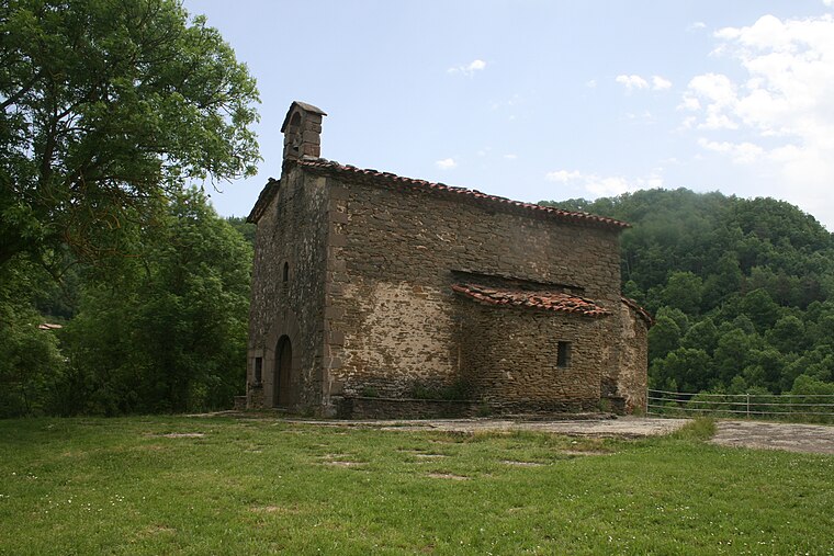
Sant Miquel de Rupit
Church

Photo: Josep Enric López, CC BY-SA 2.0.
Sant Miquel de Rupit is a church, which is situated 280 metres south of Aparcament públic de pagament.
Santa Magdalena de Rupit i Pruit
Church
 Santa Magdalena de Rupit i Pruit is a church, which is situated 450 metres south of Aparcament públic de pagament.
Salt de Sallent
Waterfall

Photo: Pallares, CC BY-SA 3.0.
Salt de Sallent is a waterfall, which is situated 1½ km southeast of Aparcament públic de pagament.
Places in the Area
Nearby places include Rupit and Pruit.
Rupit

Photo: sito.rm, CC BY-SA 3.0.
Rupit is a village in the county of Osona, in the subregion of the Collsacabra, in Catalonia, Spain. It is located at 822 m above sea level, 98 km from Barcelona.

Tavertet
Village

Photo: Jvilardell, Public domain.
Tavertet is a small town located above some cliffs, 900m above sea level, in the area known as Collsacabra, north of the Guilleries, in the comarca of Osona in Catalonia. Tavertet is situated 5 km southwest of Aparcament públic de pagament.
Aparcament públic de pagament
- Type: Parking area
- Parking: surface
- Category: transportation
- Location: Rupit i Pruit, Barcelona, Catalonia, Eastern Spain, Spain, Iberia, Europe
- View on OpenStreetMap
Latitude
42.02626° or 42° 1′ 35″ northLongitude
2.46431° or 2° 27′ 52″ eastOpen location code
8FJ42FG7+GPOpenStreetMap ID
way 33042421OpenStreetMap feature
amenity=parkingOpenStreetMap attribute
parking=surface
This page is based on OpenStreetMap, Wikidata, and Wikimedia Commons.
We’d love your help improving our open data sources. Thank you for contributing.
Satellite Map
Discover Aparcament públic de pagament from above in high-definition satellite imagery.
Places with the Same Name
Discover other places named “Aparcament públic de pagament”.
Notable Places Nearby
Highlights include Oficina de Turisme and Dipòsit d’aigua.
Nearby Places
Explore places such as l’Hort d’en Roca and Aparcament residents.
Barcelona: Must-Visit Destinations
Delve into Barcelona, Malgrat de Mar, Terrassa, and Badalona.
Curious Parking Areas to Discover
Uncover intriguing parking areas from every corner of the globe.
About Mapcarta. Data © OpenStreetMap contributors and available under the Open Database License". Text is available under the CC BY-SA 4.0 license, except for photos, directions, and the map. Photo: Alex Micheu Photography, CC BY-SA 3.0.