Belle Vue
Belle Vue is a residential area in Savanne District, Mauritius. Belle Vue is situated nearby to the town Chemin Grenier, as well as near Surinam.| Tap on a place to explore it |
Places of Interest Nearby
Highlights include Rochester Falls.
Rochester Falls
Waterfall

Photo: Maral10, Public domain.
Rochester Falls is a waterfall situated in the Savanne district of Mauritius. Highly popular for its rectangular flank rocks, the fall is one of the most popular tourist attractions and the widest waterfall in Mauritius. Rochester Falls is situated 3½ km east of Belle Vue.
Places in the Area
Nearby places include Chemin Grenier and Surinam.
Chemin Grenier
Town
Chemin-Grenier is a village in Mauritius located in Savanne District. The village is administered by the Chemin-Grenier Village Council under the aegis of the Savanne District Council.
Surinam
Town
Surinam is a village located in the Savanne District of Mauritius. According to the 2011 census by Statistics Mauritius, the population was 10,507. Nightingale College was a college in Surinam, Mauritius founded on 1 July 1964 by Seewooparsad Goolab. Surinam is situated 3 km southeast of Belle Vue.
Souillac
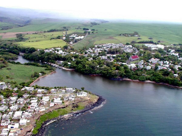
Photo: public domain, Public domain.
Souillac is a small seaside resort and village in Mauritius along the rugged coast of the Savanne district.
Belle Vue
- Type: Residential area
- Location: Savanne District, Mauritius, East African Islands, Africa
- View on OpenStreetMap
Latitude
-20.49963° or 20° 29′ 59″ southLongitude
57.48314° or 57° 28′ 59″ eastOpen location code
5HFVGF2M+47OpenStreetMap ID
way 335688684OpenStreetMap feature
landuse=residential
This page is based on OpenStreetMap, Wikidata, and Wikimedia Commons.
We’d love your help improving our open data sources. Thank you for contributing.
Satellite Map
Discover Belle Vue from above in high-definition satellite imagery.
Places with the Same Name
Discover other places named “Belle Vue”.
Notable Places Nearby
Highlights include Keats College and Shivala.
Nearby Places
Explore places such as Engen Chemin Grenier and Charles Telfair Government School.
Mauritius: Must-Visit Destinations
Delve into Port Louis, Rodrigues, Pamplemousses, and Le Morne Brabant.
Curious Residential Areas to Discover
Uncover intriguing residential areas from every corner of the globe.
About Mapcarta. Data © OpenStreetMap contributors and available under the Open Database License". Text is available under the CC BY-SA 4.0 license, except for photos, directions, and the map. Photo: Wikimedia, CC0.