La Despensa
La Despensa is a supermarket in Community of Madrid, Central Spain. La Despensa is situated nearby to the hospital Clínica López Ibor, as well as near Gerencia SERMAS.| Tap on a place to explore it |
Places of Interest Nearby
Highlights include Antonio Machado and Iglesia de la Cena del Señor, Madrid.
Antonio Machado
Metro station
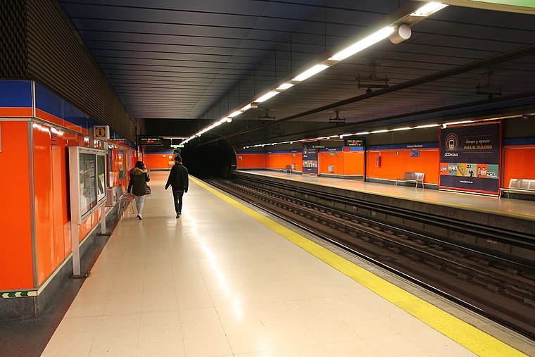
Photo: Draceane, CC BY-SA 4.0.
Antonio Machado is a station on Line 7 of the Madrid Metro, near the Calle de Antonio Machado. It is located in fare Zone A. This station close to the street of the same name, in the Valdezarza neighborhood. Antonio Machado is situated 680 metres east of La Despensa.
Iglesia de la Cena del Señor, Madrid
Church

Photo: Asqueladd, CC BY-SA 3.0.
Iglesia de la Cena del Señor, Madrid is a church, which is situated 580 metres east of La Despensa.
Valdezarza
Metro station

Photo: Draceane, CC BY-SA 4.0.
Valdezarza is a station on Line 7 of the Madrid Metro, serving the Valdezarza barrio. It is located in fare Zone A. Valdezarza is situated 1 km southeast of La Despensa.
Places in the Area
Nearby places include Valdezarza and Peñagrande.
Valdezarza
Quarter

Photo: Malopez 21, CC BY-SA 4.0.
Valdezarza is an administrative neighborhood of Madrid belonging to the district of Moncloa-Aravaca.
Peñagrande
Quarter

Photo: Asqueladd, CC BY-SA 3.0.
Peñagrande is a neighborhood to the north of Madrid's city centre, in the district of Fuencarral-El Pardo. Peñagrande is Madrid's 26th largest neighborhood in terms of land area, its 10th largest in population and 77th largest in population density.
El Pilar
Quarter

Photo: Ricardo Ricote Rodrí…, CC BY 3.0.
El Pilar is a ward of Madrid, the capital of Spain, belonging to the district of Fuencarral-El Pardo.
La Despensa
- Type: Supermarket
- Categories: building, shop, and food
- Location: Community of Madrid, Central Spain, Spain, Iberia, Europe
- View on OpenStreetMap
Latitude
40.46903° or 40° 28′ 9″ northLongitude
-3.72581° or 3° 43′ 33″ westOpen location code
8CGRF79F+JMOpenStreetMap ID
way 343982899OpenStreetMap feature
building=yesOpenStreetMap feature
shop=supermarket
This page is based on OpenStreetMap, Wikidata, and Wikimedia Commons.
We’d love your help improving our open data sources. Thank you for contributing.
Satellite Map
Discover La Despensa from above in high-definition satellite imagery.
Places with the Same Name
Discover other places named “La Despensa”.
Notable Places Nearby
Highlights include Clínica López Ibor and Gerencia SERMAS.
Nearby Places
Explore places such as López Ibor-Isla Cristina and Residencia para Mayores Sagrada Familia - Nueva Zelanda.
Community of Madrid: Must-Visit Destinations
Delve into Madrid, Alcalá de Henares, Getafe, and Aranjuez.
Curious Supermarkets to Discover
Uncover intriguing supermarkets from every corner of the globe.
About Mapcarta. Data © OpenStreetMap contributors and available under the Open Database License". Text is available under the CC BY-SA 4.0 license, except for photos, directions, and the map. Photo: Wikimedia, CC0.