The Howard Center for the Arts
The Howard Center for the Arts is a school building in Philadelphia, Philadelphia Region, Pennsylvania which is located on Wood Street. The Howard Center for the Arts is situated nearby to the community center Hoyu Folk Cultural Center, as well as near the arts center Asian Arts Initiative.| Tap on a place to explore it |
- Type: School building
- Also known as: “Edwards Shoe Manufacturing Company”
- Address: 1212 Wood Street, Philadelphia, PA 19107
Places of Interest Nearby
Highlights include Pennsylvania Academy of the Fine Arts and Independence Hall.
Pennsylvania Academy of the Fine Arts
Museum

Photo: Csrsanch, CC BY-SA 3.0.
The Pennsylvania Academy of the Fine Arts is a museum and private art school in Philadelphia, Pennsylvania. Founded in 1805, it is the longest continuously operating art museum and art school in the United States. Pennsylvania Academy of the Fine Arts is situated 1,700 feet southwest of The Howard Center for the Arts.
Independence Hall
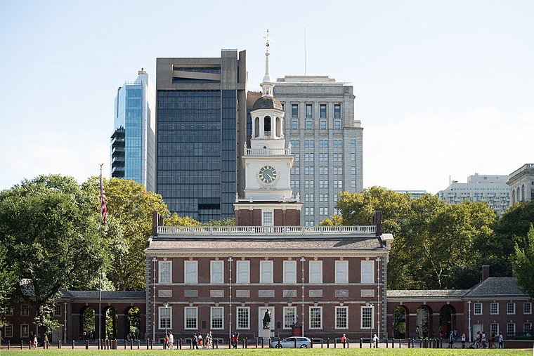
Photo: Mys 721tx, CC BY-SA 3.0.
Independence Hall is a historic civic building in Philadelphia, Pennsylvania, where both the Declaration of Independence and the Constitution of the United States were debated and adopted by the Founding Fathers of the United States. Independence Hall is situated 1 mile southeast of The Howard Center for the Arts.
Liberty Bell

Photo: tonythemisfit, CC BY 2.0.
The Liberty Bell, previously called the State House Bell or Old State House Bell, is an iconic symbol of American independence located in Philadelphia. Liberty Bell is situated 4,100 feet southeast of The Howard Center for the Arts.
Places in the Area
Nearby places include Chinatown and Center City East.
Chinatown
Neighborhood

Photo: Beyond My Ken, CC BY-SA 4.0.
Philadelphia Chinatown is a predominantly Asian American neighborhood in Center City, Philadelphia, Pennsylvania. The Philadelphia Chinatown Development Corporation supports the area.
Center City East

Photo: Eugene Kim, CC BY-SA 2.0.
City Center East is the most dense section of Philadelphia, home to City Hall, the Convention Center, Chinatown, Washington Square West, and Gayborhood.
Poplar
Neighborhood

Photo: Wikimedia, Public domain.
Poplar is a neighborhood in Lower North Philadelphia, Pennsylvania, United States. It is located north of Callowhill, between Spring Garden/Fairmount and Northern Liberties, bounded roughly by Girard Avenue to the north, North Broad Street to the west, Spring Garden Street to the south, and 5th Street to the east.
The Howard Center for the Arts
- Categories: building and education
- Location: Philadelphia, Philadelphia, Philadelphia Region, Pennsylvania, Mid-Atlantic, United States, North America
- View on OpenStreetMap
Latitude
39.95833° or 39° 57′ 30″ northLongitude
-75.15933° or 75° 9′ 34″ westLevels
2Operator
Roman Catholic High SchoolOpen location code
87F6XR5R+87OpenStreetMap ID
way 346886793OpenStreetMap feature
building=school
This page is based on OpenStreetMap, Wikidata, and Wikimedia Commons.
We’d love your help improving our open data sources. Thank you for contributing.
Satellite Map
Discover The Howard Center for the Arts from above in high-definition satellite imagery.
Notable Places Nearby
Highlights include Hoyu Folk Cultural Center and Asian Arts Initiative.
Nearby Places
Explore places such as The Howard Center for the Arts and Best Western Plus.
Philadelphia: Must-Visit Destinations
Delve into Philadelphia International Airport, Old City, West Philadelphia, and Center City West.
Curious Places to Discover
Uncover intriguing places from every corner of the globe.
About Mapcarta. Data © OpenStreetMap contributors and available under the Open Database License". Text is available under the CC BY-SA 4.0 license, except for photos, directions, and the map. Photo: Dave Z, CC BY 2.0.