Municipio di Due Carrare
Municipio di Due Carrare is a town hall in Due Carrare, Padova, Veneto. Municipio di Due Carrare is situated nearby to San Giorgio Church, as well as near the ruins Torretta (Padiglione di caccia).| Tap on a place to explore it |
Places of Interest Nearby
Highlights include San Giorgio Church and Abbazia di Santo Stefano.
San Giorgio Church
Church

Photo: Threecharlie, CC BY-SA 3.0.
San Giorgio Church is situated 120 metres northeast of Municipio di Due Carrare.
Abbazia di Santo Stefano
Church

Photo: Threecharlie, CC BY-SA 3.0.
Abbazia di Santo Stefano is a church, which is situated 640 metres southeast of Municipio di Due Carrare.
Castello del Catajo
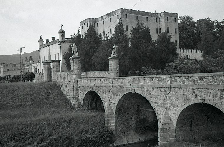
Photo: Paolo Monti, CC BY-SA 4.0.
Castello del Catajo is a patrician rural palace near the town of Battaglia Terme, province of Padua, north-eastern Italy built in 1573. Castello del Catajo is situated 2½ km west of Municipio di Due Carrare.
Places in the Area
Nearby places include Montegrotto Terme and Albignasego.
Montegrotto Terme

Photo: Threecharlie, CC BY-SA 4.0.
Montegrotto Terme is a comune in the Province of Padua in the Italian region Veneto, located about 45 kilometres west of Venice and about 11 kilometres southwest of Padua.
Albignasego
Town

Photo: Threecharlie, CC BY-SA 3.0.
Albignasego is a comune in the Province of Padua in the Italian region Veneto, located about 35 kilometres west of Venice and about 7 kilometres south of Padua. Albignasego is situated 7 km northeast of Municipio di Due Carrare.
Abano Terme
Town
Photo: Paolobon140, CC BY-SA 4.0.
Abano Terme is a town and comune in the Province of Padua, in the Veneto region, Italy, on the eastern slope of the Euganean Hills; it is 10 kilometres southwest by rail from Padua. Abano Terme is situated 8 km north of Municipio di Due Carrare.
Municipio di Due Carrare
- Type: Town hall
- Categories: building, public building, and government building
- Location: Due Carrare, Padova, Veneto, Northeast Italy, Italy, Europe
- View on OpenStreetMap
Latitude
45.29152° or 45° 17′ 30″ northLongitude
11.8209° or 11° 49′ 15″ eastOpen location code
8FQH7RRC+J9OpenStreetMap ID
way 351728253OpenStreetMap feature
amenity=townhallOpenStreetMap feature
building=public
This page is based on OpenStreetMap, Wikidata, and Wikimedia Commons.
We’d love your help improving our open data sources. Thank you for contributing.
Satellite Map
Discover Municipio di Due Carrare from above in high-definition satellite imagery.
Notable Places Nearby
Highlights include Torretta (Padiglione di caccia) and Monticello dei Carraresi.
Nearby Places
Explore places such as Farmacia Fortini and Monde dei Paschi - Antonveneta.
Curious Town Halls to Discover
Uncover intriguing town halls from every corner of the globe.
About Mapcarta. Data © OpenStreetMap contributors and available under the Open Database License". Text is available under the CC BY-SA 4.0 license, except for photos, directions, and the map. Photo: Pmk58, CC BY-SA 4.0.