High Fish Pond
High Fish Pond is in Wintringham, Ryedale District, England. High Fish Pond is situated nearby to the forest Mill Plantation, as well as near Scampston Bridge.| Tap on a place to explore it |
Places of Interest Nearby
Highlights include Church of St Martin and All Saints Church, Thorpe Bassett.
Church of St Martin
Church

Photo: Pauline E, CC BY-SA 2.0.
Church of St Martin is situated 3,600 feet northwest of High Fish Pond.
All Saints Church, Thorpe Bassett
Church
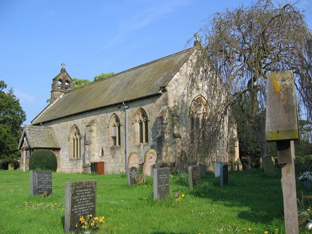
Photo: Stephen Horncastle, CC BY-SA 2.0.
All Saints Church is in the village of Thorpe Bassett, North Yorkshire, England. It is an active Anglican parish church in the deanery of Southern Ryedale, the archdeaconry of York, and the diocese of York. All Saints Church, Thorpe Bassett is situated 1 mile southwest of High Fish Pond.
St Andrew’s Church, Rillington
Church

Photo: Nigelcoates, CC BY-SA 3.0.
St Andrew's Church is the parish church of Rillington, a village in North Yorkshire, in England. The church was built in the 12th century and the chancel and arcade were added in about 1250, when Robert de Okham was appointed as the priest. St Andrew’s Church, Rillington is situated 1 mile west of High Fish Pond.
Places in the Area
Nearby places include West Knapton and East Knapton.
West Knapton
Hamlet

Photo: Wikimedia, CC BY-SA 2.0.
West Knapton is a small village in the civil parish of Scampston, in North Yorkshire, England. It is situated on the edge of the Yorkshire Wolds at the foot of the North York Moors.
East Knapton
Hamlet

Photo: Wikimedia, CC BY-SA 2.0.
East Knapton is a village in the civil parish of Scampston, in North Yorkshire, England.
Scagglethorpe
Village

Photo: Peter Church, CC BY-SA 2.0.
Scagglethorpe is a village and civil parish in the Ryedale district of North Yorkshire, England. It is situated just south from the A64 road, 3 miles east from Malton and almost midway between York and Scarborough. Scagglethorpe is situated 2½ miles southwest of High Fish Pond.
High Fish Pond
Latitude
54.15988° or 54° 9′ 36″ northLongitude
-0.67278° or 0° 40′ 22″ westOpen location code
9C6X585G+XVOpenStreetMap ID
way 353507118OpenStreetMap feature
natural=water
This page is based on OpenStreetMap, Wikidata, and Wikimedia Commons.
We’d love your help improving our open data sources. Thank you for contributing.
Satellite Map
Discover High Fish Pond from above in high-definition satellite imagery.
Notable Places Nearby
Highlights include Mill Plantation and Scampston Bridge.
Nearby Places
Explore places such as Mill Pond and Wintringham Lane End.
North Yorkshire: Must-Visit Destinations
Delve into York, Middlesbrough, Harrogate, and Ripon.
Curious Places to Discover
Uncover intriguing places from every corner of the globe.
About Mapcarta. Data © OpenStreetMap contributors and available under the Open Database License". Text is available under the CC BY-SA 4.0 license, except for photos, directions, and the map. Photo: Michael Bryan, CC BY 2.0.