Centro de Servicios Sociales San Vicente de Paúl
Centro de Servicios Sociales San Vicente de Paúl is a social service facility in Community of Madrid, Central Spain. Centro de Servicios Sociales San Vicente de Paúl is situated nearby to the church Testigos Cristianos de Jehová, as well as near (Área sin edificar).| Tap on a place to explore it |
Places of Interest Nearby
Highlights include Antonio Machado and Peñagrande.
Antonio Machado
Metro station
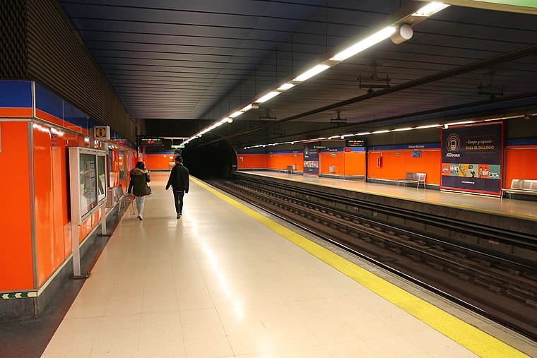
Photo: Draceane, CC BY-SA 4.0.
Antonio Machado is a station on Line 7 of the Madrid Metro, near the Calle de Antonio Machado. It is located in fare Zone A. This station close to the street of the same name, in the Valdezarza neighborhood. Antonio Machado is situated 280 metres southwest of Centro de Servicios Sociales San Vicente de Paúl.
Peñagrande
Metro station

Photo: Draceane, CC BY-SA 4.0.
Peñagrande is a station on Line 7 of the Madrid Metro, serving the barrio of Peñagrande. It is located in fare Zone A. Peñagrande is situated 390 metres north of Centro de Servicios Sociales San Vicente de Paúl.
Iglesia de la Cena del Señor, Madrid
Church

Photo: Asqueladd, CC BY-SA 3.0.
Iglesia de la Cena del Señor, Madrid is a church, which is situated 620 metres southwest of Centro de Servicios Sociales San Vicente de Paúl.
Places in the Area
Nearby places include El Pilar and Valdezarza.
El Pilar
Quarter

Photo: Ricardo Ricote Rodrí…, CC BY 3.0.
El Pilar is a ward of Madrid, the capital of Spain, belonging to the district of Fuencarral-El Pardo.
Valdezarza
Quarter

Photo: Malopez 21, CC BY-SA 4.0.
Valdezarza is an administrative neighborhood of Madrid belonging to the district of Moncloa-Aravaca.
Peñagrande
Quarter

Photo: Asqueladd, CC BY-SA 3.0.
Peñagrande is a neighborhood to the north of Madrid's city centre, in the district of Fuencarral-El Pardo. Peñagrande is Madrid's 26th largest neighborhood in terms of land area, its 10th largest in population and 77th largest in population density.
Centro de Servicios Sociales San Vicente de Paúl
- Type: Social service facility
- Category: building
- Location: Community of Madrid, Central Spain, Spain, Iberia, Europe
- View on OpenStreetMap
Latitude
40.47242° or 40° 28′ 21″ northLongitude
-3.71623° or 3° 42′ 58″ westLevels
2Operator
Ayuntamiento de MadridOpen location code
8CGRF7CM+XGOpenStreetMap ID
way 355350995OpenStreetMap feature
amenity=social_facilityOpenStreetMap feature
building=yes
This page is based on OpenStreetMap, Wikidata, and Wikimedia Commons.
We’d love your help improving our open data sources. Thank you for contributing.
Satellite Map
Discover Centro de Servicios Sociales San Vicente de Paúl from above in high-definition satellite imagery.
Notable Places Nearby
Highlights include Testigos Cristianos de Jehová and (Área sin edificar).
Nearby Places
Explore places such as Escuela infantil municipal La Corte de Faraón and Centro de Salud Doctor Castroviejo.
Community of Madrid: Must-Visit Destinations
Delve into Madrid, Alcalá de Henares, Getafe, and Aranjuez.
Curious Social Service Facilities to Discover
Uncover intriguing social service facilities from every corner of the globe.
About Mapcarta. Data © OpenStreetMap contributors and available under the Open Database License". Text is available under the CC BY-SA 4.0 license, except for photos, directions, and the map. Photo: Wikimedia, CC0.