Complexo Social Marinel (Exército de Salvação)
Complexo Social Marinel (Exército de Salvação) is a social service facility in Colares, Sintra, Lisbon District which is located on Rua das Marinhas. Complexo Social Marinel (Exército de Salvação) is situated nearby to the post office Correios, as well as near the fountain Fonte dos Amores.| Tap on a place to explore it |
Places of Interest Nearby
Highlights include Praia das Maçãs Prehistoric Monument and Praia das Macãs.
Praia das Maçãs Prehistoric Monument
Archaeological site
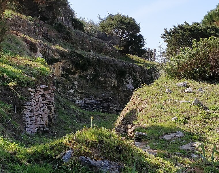
Photo: Roundtheworld, CC BY-SA 4.0.
The Praia das Maçãs Prehistoric Monument, also known as the Tholos of Outeiro das Mós, consists of an artificial Neolithic cave and a Chalcolithic domed or beehive tomb. Praia das Maçãs Prehistoric Monument is situated 530 metres southwest of Complexo Social Marinel (Exército de Salvação).

Archaeological Site of Alto da Vigia
Archaeological site

Photo: Opus 113, CC BY-SA 4.0.
The Archaeological Site of Alto da Vigia is an archaeological site associated with Roman interventions in the Portugal, situated along the Praia das Maçãs in the civil parish of Colares, in municipality of Sintra. Archaeological Site of Alto da Vigia is situated 1 km southwest of Complexo Social Marinel (Exército de Salvação).
Places in the Area
Nearby places include Praia das Maçãs and Azenhas do Mar.
Praia das Maçãs
Neighborhood

Photo: Rúdisicyon, CC BY-SA 4.0.
Sintra is a town in Greater Lisbon, Estremadura, Portugal. Its spectacular setting, 28 km from Lisbon, houses a Royal Palace, used by generations of Portuguese royalty prior to the 1910 revolution.
Azenhas do Mar
Hamlet

Photo: F Mira, CC BY-SA 2.0.
Azenhas do Mar is a seaside village in the civil parish of Colares, Sintra, Portugal. It is situated on a cliff along the Atlantic Ocean, about 30 km northwest of Lisbon, within the Sintra-Cascais Natural Park.

Complexo Social Marinel (Exército de Salvação)
- Type: Social service facility
- Address: Rua das Marinhas 13, Praia das Maçãs, 2705-313
- Category: building
- Location: Colares, Sintra, Lisbon District, Portugal, Iberia, Europe
- View on OpenStreetMap
Latitude
38.83047° or 38° 49′ 50″ northLongitude
-9.46327° or 9° 27′ 48″ westLevels
2Open location code
8CCGRGJP+5MOpenStreetMap ID
way 364157120OpenStreetMap feature
amenity=social_facilityOpenStreetMap feature
building=yes
This page is based on OpenStreetMap, Wikidata, and Wikimedia Commons.
We’d love your help improving our open data sources. Thank you for contributing.
Satellite Map
Discover Complexo Social Marinel (Exército de Salvação) from above in high-definition satellite imagery.
Notable Places Nearby
Highlights include Fonte dos Amores and Correios.
Nearby Places
Explore places such as Reservatório and Minimercado Golfinho.
Portugal: Must-Visit Destinations
Delve into Lisbon, Caldas da Rainha, Porto, and Coimbra.
Curious Social Service Facilities to Discover
Uncover intriguing social service facilities from every corner of the globe.
About Mapcarta. Data © OpenStreetMap contributors and available under the Open Database License". Text is available under the CC BY-SA 4.0 license, except for photos, directions, and the map. Photo: Alvesgaspar, CC BY-SA 3.0.