دبیرستان دوره اول دخترانه سما
دبیرستان دوره اول دخترانه سما is a school building in Markazi Province, Iran. دبیرستان دوره اول دخترانه سما is situated nearby to the mosque مسجد ابوالفضل, as well as near the park پارک حافظیه.| Tap on a place to explore it |
Places of Interest Nearby
Highlights include Wagon Pars and Machine Sazi Arak.
Wagon Pars
 Wagon Pars is an Iranian train and locomotive manufacturer established in 1974, in Arak. Products include locomotives, trains, metros, freight and fuel railroad cars, and equipment for passenger boarding of aircraft. Wagon Pars is situated 3 km south of دبیرستان دوره اول دخترانه سما.
Machine Sazi Arak
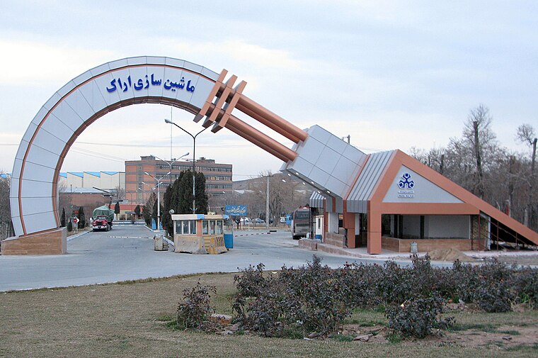
Photo: Iranian engineer, CC BY-SA 3.0.
Machine Sazi Arak is an Iranian industrial machinery and equipment manufacturing corporation that was established in 1967 in an area of 134 hectares in the city of Arak in order to support underlying industries and meet the industrial needs of the country. Machine Sazi Arak is situated 3½ km southeast of دبیرستان دوره اول دخترانه سما.
Bazaar of Arak
Commercial area

Photo: Kiantavakoli, CC BY-SA 4.0.
The Bazaar of Arak is a bazaar, located in Arak, in the province of Markazi, Iran. It was one of the first constructed buildings in the city. The bazaar complex, containing a public bath, a mosque, water reservoirs, passages and caravansary, was built at the time of Fath-Ali Shah Qajar and by Yusef Khan-e Gorji, in the middle of Sultan Abad. Bazaar of Arak is situated 3½ km southwest of دبیرستان دوره اول دخترانه سما.
Places in the Area
Nearby places include Arak and Cheqa, Markazi.
Arak
 Arak, also known as Soltan Abad, is a major industrial city of 550,000 and the capital of Markazi Province in Western Iran.
Cheqa, Markazi
Village
Cheqa is a village in Masumiyeh Rural District, in the Central District of Arak County, Markazi Province, Iran. At the 2006 census, its population was 55, in 13 families. Cheqa, Markazi is situated 5 km east of دبیرستان دوره اول دخترانه سما.
Naz̧mābād
Village

Photo: Ali Sharifi, CC BY 3.0.
Nazmabad is a village in Sedeh Rural District, in the Central District of Arak County, Markazi Province, Iran. At the 2006 census, its population was 453, in 139 families. Naz̧mābād is situated 6 km south of دبیرستان دوره اول دخترانه سما.
دبیرستان دوره اول دخترانه سما
- Type: School building
- Categories: building and education
- Location: Markazi Province, Iran, Middle East, Asia
- View on OpenStreetMap
Latitude
34.10607° or 34° 6′ 22″ northLongitude
49.72375° or 49° 43′ 26″ eastOpen location code
8H6F4P4F+CGOpenStreetMap ID
way 373978209OpenStreetMap feature
building=school
This page is based on OpenStreetMap, Wikidata, and Wikimedia Commons.
We’d love your help improving our open data sources. Thank you for contributing.
Satellite Map
Discover دبیرستان دوره اول دخترانه سما from above in high-definition satellite imagery.
Notable Places Nearby
Highlights include مسجد ابوالفضل and پارک حافظیه.
Nearby Places
Explore places such as لوازم آلتحریر and آژانس.
Iran: Must-Visit Destinations
Delve into Tehran, Isfahan, Tabriz, and Sistan and Baluchestan.
Curious Schools to Discover
Uncover intriguing schools from every corner of the globe.
About Mapcarta. Data © OpenStreetMap contributors and available under the Open Database License". Text is available under the CC BY-SA 4.0 license, except for photos, directions, and the map. Photo: Wikimedia, CC0.