Parroquia de San Valentín y San Casimiro
Parroquia de San Valentín y San Casimiro is a church in Vicálvaro, Madrid, Community of Madrid. Parroquia de San Valentín y San Casimiro is situated nearby to the community center Fundación Juan XXIII, as well as near the pitch Santo Padel Madrid.| Tap on a place to explore it |
Places of Interest Nearby
Highlights include Vicálvaro and Puerta de Arganda.
Vicálvaro
Railway station
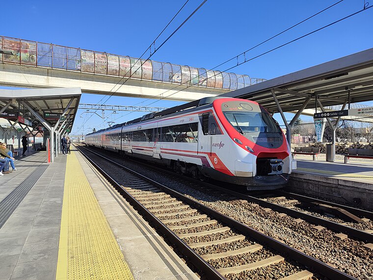
Photo: KingValid04, CC BY-SA 4.0.
Vicálvaro is a railway station, which is situated 420 metres southwest of Parroquia de San Valentín y San Casimiro.
Puerta de Arganda
Metro station

Photo: Draceane, CC BY-SA 4.0.
Puerta de Arganda is a station of the Metro Madrid. It is located in fare Zone A of the CRTM. Due to it being the southern endpoint of Line 9A, it serves as an interchange station to both Line 9B towards Rivas-Vaciamadrid and Arganda del Rey and via Vicálvaro railway station to the Cercanías service (lines C-2, C-7 and C-8. Puerta de Arganda is situated 410 metres southwest of Parroquia de San Valentín y San Casimiro.
San Cipriano
Metro station

Photo: Draceane, CC BY-SA 4.0.
San Cipriano is a station on Line 9 of the Madrid Metro, under the Calle de San Cipriano. It is located in fare Zone A. San Cipriano is situated 1 km west of Parroquia de San Valentín y San Casimiro.
Places in the Area
Nearby places include Vicálvaro and Valderrivas.
Vicálvaro
Suburb

Photo: ivan.zaragoza, CC BY 3.0.
Vicálvaro is a district in the southeast of Madrid, Spain. It is named after the former municipality absorbed into the municipality of Madrid in 1951.
Valderrivas
Quarter

Photo: Asqueladd, CC BY-SA 3.0.
Valderrivas is an administrative neighborhood of Madrid belonging to the district of Vicálvaro. It was formally constituted as independent entity in November 2017, after the administrative reorganization of the district passed by the Plenary of the Ayuntamiento de Madrid on 31 October 2017.
Casco Histórico de Vicálvaro
Quarter
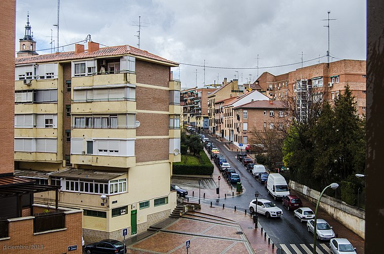
Photo: MottaW, CC BY-SA 3.0.
Casco Histórico de Vicálvaro is an administrative neighborhood of Madrid belonging to the district of Vicálvaro. It is the largest neighborhood in the district.
Parroquia de San Valentín y San Casimiro
- Type: Church
- Denomination: Catholic
- Categories: building, place of worship, and religion
- Location: Vicálvaro, Madrid, Madrid, Community of Madrid, Central Spain, Spain, Iberia, Europe
- View on OpenStreetMap
Latitude
40.40406° or 40° 24′ 15″ northLongitude
-3.59256° or 3° 35′ 33″ westLevels
1Open location code
8CGRCC34+JXOpenStreetMap ID
way 374258784OpenStreetMap feature
amenity=place_of_worshipOpenStreetMap feature
building=churchOpenStreetMap attribute
denomination=catholic
This page is based on OpenStreetMap, Wikidata, and Wikimedia Commons.
We’d love your help improving our open data sources. Thank you for contributing.
Satellite Map
Discover Parroquia de San Valentín y San Casimiro from above in high-definition satellite imagery.
Notable Places Nearby
Highlights include Fundación Juan XXIII and Santo Padel Madrid.
Nearby Places
Explore places such as Escuela Infantil Mundo Mágico and Aparthotel Encasa.
Madrid: Must-Visit Destinations
Delve into Sol-Letras-Lavapiés, Salamanca, Retiro-Paseo del Arte, and Chamberí-Castellana.
Curious Churches to Discover
Uncover intriguing churches from every corner of the globe.
About Mapcarta. Data © OpenStreetMap contributors and available under the Open Database License". Text is available under the CC BY-SA 4.0 license, except for photos, directions, and the map. Photo: DonPaolo, CC BY-SA 3.0.