Bestway
Bestway is a warehouse in Ealing, Greater London, England. Bestway is situated nearby to Bulls Bridge Wet & Dry Docks, as well as near Featherstone Primary and Nursery School.| Tap on a place to explore it |
Places of Interest Nearby
Highlights include Hayes & Harlington railway station and Southall railway station.
Hayes & Harlington railway station
Railway station
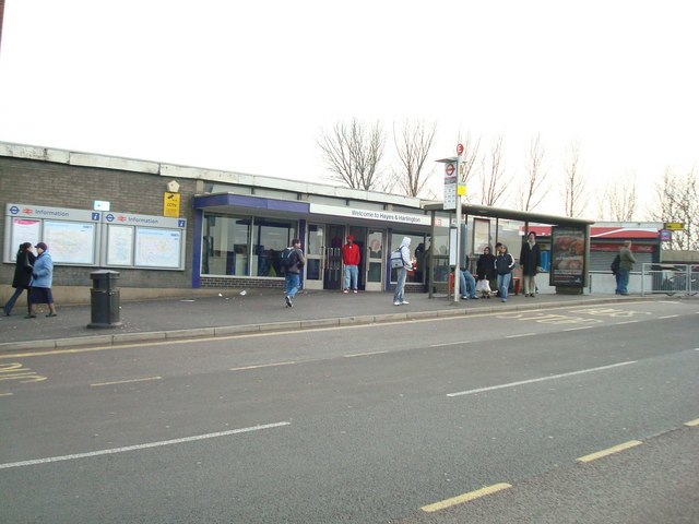
Photo: Stacey Harris, CC BY-SA 2.0.
Hayes & Harlington is a railway station serving the west London districts Hayes and Harlington in the London Borough of Hillingdon. It is in London fare zone 5, 10 miles 71 chains down the line from London Paddington and is situated between Southall and West Drayton. Hayes & Harlington railway station is situated 1 mile west of Bestway.
Southall railway station
Railway station

Photo: Sunil060902, CC BY-SA 3.0.
Southall is a step-free access railway station on the Great Western Main Line in Southall, London, England. It is in London fare zone 4 and passenger services are provided by the Elizabeth line from London Paddington. Southall railway station is situated 1¼ miles northeast of Bestway.
Western International Market

Photo: Ray Stanton, CC BY-SA 2.0.
The Western International Market is a wholesale market in west London, England. One of the principal wholesale markets in the London region, it is located between Southall and Hayes, close to the M4 motorway and Heathrow Airport, and covers an area of 86 acres. Western International Market is situated 1,400 feet southwest of Bestway.
Places in the Area
Nearby places include West London and Hayes.
West London

Photo: brett jordan, CC BY 2.0.
The outer western suburbs of Greater London form a diverse area that ranges from the densely-populated but tree-lined streets of Chiswick, Acton and Ealing, through to the semi-rural western districts that lie between Heathrow Airport and Uxbridge.
Hayes
Suburb

Photo: Peter Clare, CC BY-SA 2.0.
Hayes is a town in west London. Historically situated within the county of Middlesex, it is now part of the London Borough of Hillingdon. The town's population, including its localities Hayes End, Harlington and Yeading, was recorded in the 2021 census as 93,928.
Norwood Green
Village

Photo: Chris Martin, CC BY-SA 2.0.
Norwood Green is a place in the London Borough of Ealing in London, England, that forms the southern part of Southall. It is a suburban development centred 10.7 miles west of Charing Cross and 4 miles ENE of Heathrow Airport.
Bestway
- Type: Warehouse
- Category: building
- Location: Ealing, Greater London, England, United Kingdom, Britain and Ireland, Europe
- View on OpenStreetMap
Latitude
51.49913° or 51° 29′ 57″ northLongitude
-0.40129° or 0° 24′ 5″ westOpen location code
9C3XFHXX+MFOpenStreetMap ID
way 37841334OpenStreetMap feature
building=warehouse
This page is based on OpenStreetMap, Wikidata, and Wikimedia Commons.
We’d love your help improving our open data sources. Thank you for contributing.
Satellite Map
Discover Bestway from above in high-definition satellite imagery.
Places with the Same Name
Discover other places named “Bestway”.
Notable Places Nearby
Highlights include Bulls Bridge Wet & Dry Docks and Featherstone Primary and Nursery School.
Nearby Places
Explore places such as International Trading Estate and Delice de France.
England: Must-Visit Destinations
Delve into London, Manchester, Sheffield, and Leeds.
Curious Warehouses to Discover
Uncover intriguing warehouses from every corner of the globe.
About Mapcarta. Data © OpenStreetMap contributors and available under the Open Database License". Text is available under the CC BY-SA 4.0 license, except for photos, directions, and the map. Photo: sidibousaid, CC BY 2.0.