Parcheggio Bar San Giorgio
Parcheggio Bar San Giorgio is a parking area in Velo d’Astico, Vicenza, Veneto. Parcheggio Bar San Giorgio is situated nearby to the park Parco giochi San Giorgio, as well as near Saint George church.| Tap on a place to explore it |
Places of Interest Nearby
Highlights include Saint George church and Monte Cengio.
Saint George church
Church

Photo: Syrio, CC BY-SA 4.0.
Saint George church is situated 190 metres north of Parcheggio Bar San Giorgio.
Monte Cengio
Peak

Photo: Nordavind1709, CC BY-SA 3.0.
Monte Cengio is a mountain in the Asiago plateau, within the Vicentine Alps, in Veneto, northeastern Italy. It has an elevation of 1,354 metres and is located on the southwestern edge of the plateau, in the territory of Cogollo del Cengio. Monte Cengio is situated 3 km north of Parcheggio Bar San Giorgio.
Monte Summano
Peak

Photo: Twice25, CC BY-SA 3.0.
Monte Summano is a mountain in the Veneto region, Italy. It has an elevation of 1,296 metres. Monte Summano is situated 3 km south of Parcheggio Bar San Giorgio.
Places in the Area
Nearby places include Tretto and Treschè Conca.
Tretto
Suburb
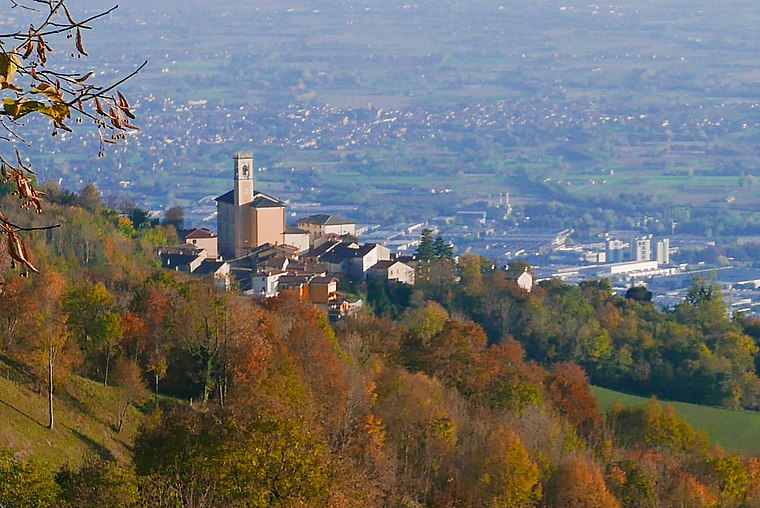
Photo: Claudio Gioseffi, CC BY-SA 4.0.
Tretto is a suburb, which is situated 5 km southwest of Parcheggio Bar San Giorgio.
Treschè Conca
Village

Photo: Syrio, CC BY-SA 4.0.
Treschè Conca is a village, which is situated 7 km northeast of Parcheggio Bar San Giorgio.
Cesuna
Village

Photo: Patafisik, CC BY-SA 4.0.
Cesuna is a village, which is situated 8 km northeast of Parcheggio Bar San Giorgio.
Parcheggio Bar San Giorgio
- Type: Parking area
- Parking: surface
- Category: transportation
- Location: Velo d’Astico, Vicenza, Veneto, Northeast Italy, Italy, Europe
- View on OpenStreetMap
Latitude
45.78563° or 45° 47′ 8″ northLongitude
11.38763° or 11° 23′ 16″ eastOpen location code
8FQHQ9PQ+73OpenStreetMap ID
way 387315915OpenStreetMap feature
amenity=parkingOpenStreetMap attribute
parking=surface
This page is based on OpenStreetMap, Wikidata, and Wikimedia Commons.
We’d love your help improving our open data sources. Thank you for contributing.
Satellite Map
Discover Parcheggio Bar San Giorgio from above in high-definition satellite imagery.
Notable Places Nearby
Highlights include Parco giochi San Giorgio and Santissima Trinità.
Nearby Places
Explore places such as Kiosk San Giorgio and Curegno.
Curious Parking Areas to Discover
Uncover intriguing parking areas from every corner of the globe.
About Mapcarta. Data © OpenStreetMap contributors and available under the Open Database License". Text is available under the CC BY-SA 4.0 license, except for photos, directions, and the map. Photo: Wikimedia, CC0.