Place des Martyrs de la Déportation
Place des Martyrs de la Déportation is a village green in Vitry-sur-Seine, Arrondissement of L’Haÿ-les-Roses, Île-de-France. Place des Martyrs de la Déportation is situated nearby to the bike rental Camille Groult - Guy Môquet, as well as near the government office Centre des Finances Publiques - Services des Impots.| Tap on a place to explore it |
Places of Interest Nearby
Highlights include Camille Groult - Guy Môquet and Exploradôme.
Camille Groult - Guy Môquet
Bike rental

Photo: Chabe01, CC BY-SA 4.0.
Camille Groult - Guy Môquet is a bike rental.
Exploradôme
Museum
Photo: Wikimedia, CC BY-SA 4.0.
The Exploradôme is a science museum located in Vitry-sur-Seine in the Val-de-Marne, France. It was founded by Goéry Delacôte. It is open daily; an admission fee is charged. Exploradôme is situated 670 metres northwest of Place des Martyrs de la Déportation.
Église Saint-Germain de Vitry-sur-Seine
Church

Photo: Chabe01, CC BY-SA 4.0.
Église Saint-Germain de Vitry-sur-Seine is a church, which is situated 470 metres northwest of Place des Martyrs de la Déportation.
Places in the Area
Nearby places include Alfortville and Villejuif.
Alfortville
Town
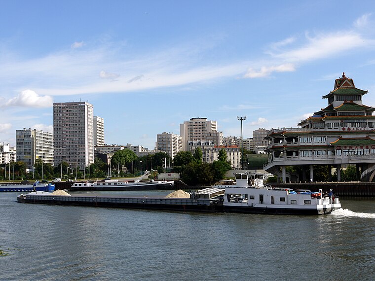
Photo: Pline, CC BY-SA 3.0.
Alfortville is a commune in the Val-de-Marne department in the southeastern suburbs of Paris, France. It is located 7.6 km from the center of Paris. It is one of the 13 communes in the intercommunality of Métropole du Grand Paris. Alfortville is situated 2½ km northeast of Place des Martyrs de la Déportation.
Villejuif
Town
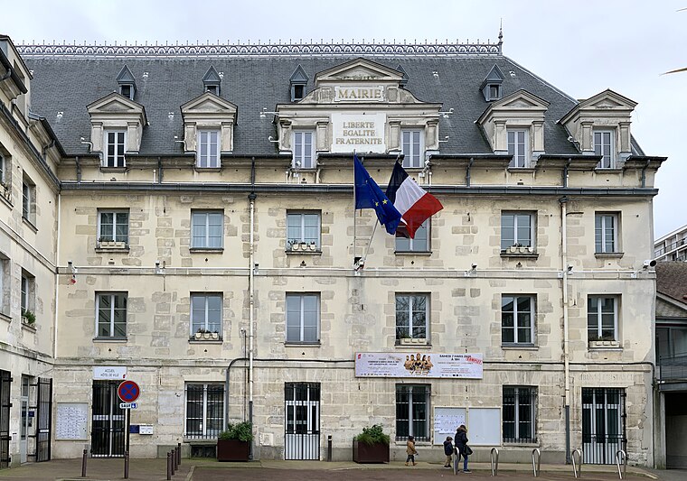
Photo: Chabe01, CC BY-SA 4.0.
Villejuif is a commune in the southern suburbs of Paris, France. It is located 7 km from the centre of Paris. Villejuif is situated 2½ km west of Place des Martyrs de la Déportation.
Thiais
Town

Photo: besopha, CC BY-SA 2.0.
Thiais is a commune in the southern suburbs of Paris, France. It is located 10.3 km from the center of Paris. The name Thiais comes from Medieval Latin Theodasium or Theodaxium, meaning "estate of Theodasius", a Gallo-Roman landowner. Thiais is situated 2½ km south of Place des Martyrs de la Déportation.
Place des Martyrs de la Déportation
Latitude
48.78798° or 48° 47′ 17″ northLongitude
2.39759° or 2° 23′ 51″ eastOpen location code
8FW4Q9QX+52OpenStreetMap ID
way 401665909OpenStreetMap feature
landuse=village_green
This page is based on OpenStreetMap, Wikidata, and Wikimedia Commons.
We’d love your help improving our open data sources. Thank you for contributing.
Satellite Map
Discover Place des Martyrs de la Déportation from above in high-definition satellite imagery.
Notable Places Nearby
Highlights include Centre des Finances Publiques - Services des Impots and Parc Daniel Féry.
Nearby Places
Explore places such as Serres municipales and École Municipale Artistique.
Île-de-France: Must-Visit Destinations
Delve into Paris, Versailles, Boulogne-Billancourt, and Paris Charles de Gaulle Airport.
Curious Village Greens to Discover
Uncover intriguing village greens from every corner of the globe.
About Mapcarta. Data © OpenStreetMap contributors and available under the Open Database License". Text is available under the CC BY-SA 4.0 license, except for photos, directions, and the map. Photo: Guillaume Baviere, CC BY 2.0.