Stade des cendrennes
Stade des cendrennes is a pitch in Saint-Germain-lès-Arpajon, Arrondissement of Palaiseau, Île-de-France. Stade des cendrennes is situated nearby to Centre équestre du Petit Hippo, as well as near the sports venue Stade du Mesnil.| Tap on a place to explore it |
Places of Interest Nearby
Highlights include Gare de La Norville - Saint-Germain-lès-Arpajon and Brétigny station.
Gare de La Norville - Saint-Germain-lès-Arpajon
Railway station

Photo: Geralix, CC BY-SA 3.0.
Gare de La Norville - Saint-Germain-lès-Arpajon is a railway station, which is situated 1¼ km south of Stade des cendrennes.
Brétigny station
Railway station

Photo: Geralix, CC BY-SA 3.0.
Brétigny is a railway station in Brétigny-sur-Orge, Essonne, Paris, France. The station was opened in 1865 and is located on the Paris–Bordeaux railway and Paris–Tours railway. Brétigny station is situated 2 km east of Stade des cendrennes.
Town hall
Town hall

Photo: GFreihalter, CC BY-SA 3.0.
Town hall is situated 2½ km southwest of Stade des cendrennes.
Places in the Area
Nearby places include La Norville and Arpajon.
La Norville
Village

Photo: JC Allin, CC BY-SA 3.0.
La Norville is a commune in the Essonne department in Île-de-France in northern France.
Arpajon
Town

Photo: Cyrilb1881, CC BY-SA 3.0.
Arpajon is a commune in the Essonne department in the Île-de-France region of northern France. The commune has been awarded three flowers by the National Council of Towns and Villages in Bloom in the Competition of cities and villages in Bloom.
Brétigny-sur-Orge
Town
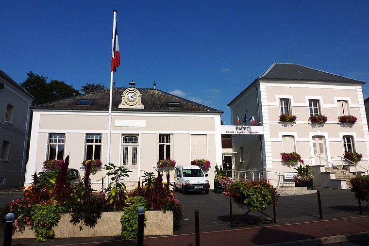
Photo: Erdrokan, CC BY-SA 3.0.
Brétigny-sur-Orge is a commune in the southern suburbs of Paris, France, 26.7 km from the city center. Brétigny-sur-Orge is situated 2½ km east of Stade des cendrennes.
Stade des cendrennes
- Type: Pitch
- Categories: recreation area, football, and sports location
- Location: Saint-Germain-lès-Arpajon, Arrondissement of Palaiseau, Essonne, Île-de-France, France, Europe
- View on OpenStreetMap
Latitude
48.60292° or 48° 36′ 11″ northLongitude
2.27392° or 2° 16′ 26″ eastOpen location code
8FW4J73F+5HOpenStreetMap ID
way 403373357OpenStreetMap feature
leisure=pitchOpenStreetMap feature
sport=soccer
This page is based on OpenStreetMap, Wikidata, and Wikimedia Commons.
We’d love your help improving our open data sources. Thank you for contributing.
Satellite Map
Discover Stade des cendrennes from above in high-definition satellite imagery.
Notable Places Nearby
Highlights include Centre équestre du Petit Hippo and Stade du Mesnil.
Nearby Places
Explore places such as Résidence Louis Aragon and Cendrennes.
Île-de-France: Must-Visit Destinations
Delve into Paris, Versailles, Boulogne-Billancourt, and Paris Charles de Gaulle Airport.
Curious Pitches to Discover
Uncover intriguing pitches from every corner of the globe.
About Mapcarta. Data © OpenStreetMap contributors and available under the Open Database License". Text is available under the CC BY-SA 4.0 license, except for photos, directions, and the map. Photo: Olybrius, CC BY-SA 3.0.