Crèche Galatea
Crèche Galatea is a kindergarten in Schaarbeek, Arrondissement of Brussels-Capital. Crèche Galatea is situated nearby to Mosquée Kouba, as well as near Maison Langbehn.| Tap on a place to explore it |
Places of Interest Nearby
Highlights include Schaerbeek Municipal Hall and Brussels-North Railway Station.
Schaerbeek Municipal Hall
Town hall

Photo: M0tty, CC BY-SA 3.0.
The Municipal Hall of Schaerbeek is the municipal hall building and the seat of that municipality of Brussels, Belgium. Designed by the architect Jules Jacques Van Ysendyck in neo-Flemish Renaissance style and completed in 1887, it is located at the centre of the Place Colignon/Colignonplein. Schaerbeek Municipal Hall is situated 300 metres southeast of Crèche Galatea.
Brussels-North Railway Station
Railway station
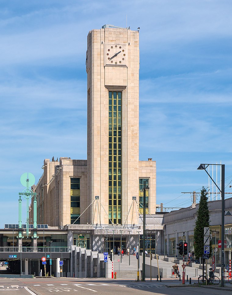 Brussels-North railway station is one of the three major railway stations in Brussels, Belgium; the other two are Brussels-Central and Brussels-South. Every regular domestic and international train passing there has a planned stop. Brussels-North Railway Station is situated 1¼ km southwest of Crèche Galatea.
Schaerbeek railway station
Railway station
 Schaerbeek railway station or Schaarbeek railway station is a railway station in the municipality of Schaerbeek in Brussels, Belgium, opened in 1887. The train services are operated by the National Railway Company of Belgium. Schaerbeek railway station is situated 1¼ km northeast of Crèche Galatea.
Places in the Area
Nearby places include Bear Pit and Little Anatolia.


Business District

Photo: Wikimedia, CC BY-SA 2.0.
The Business District is a district in Brussels, Belgium.
Crèche Galatea
- Type: Kindergarten
- Category: education
- Location: Schaarbeek, Arrondissement of Brussels-Capital, Brussels, Brussels Capital, Brussels, Belgium, Benelux, Europe
- View on OpenStreetMap
Latitude
50.86938° or 50° 52′ 10″ northLongitude
4.37052° or 4° 22′ 14″ eastOpen location code
9F26V99C+Q6OpenStreetMap ID
way 418059968OpenStreetMap feature
amenity=kindergarten
This page is based on OpenStreetMap, Wikidata, and Wikimedia Commons.
We’d love your help improving our open data sources. Thank you for contributing.
Satellite Map
Discover Crèche Galatea from above in high-definition satellite imagery.
Notable Places Nearby
Highlights include Mosquée Kouba and Maison Langbehn.
Nearby Places
Explore places such as Pavillon - Paviljoen and Snack Salam.
Brussels: Must-Visit Destinations
Delve into Pentagon, Brussels Airport, Centre, and Molenbeek and surroundings.
Curious Kindergartens to Discover
Uncover intriguing kindergartens from every corner of the globe.
About Mapcarta. Data © OpenStreetMap contributors and available under the Open Database License". Text is available under the CC BY-SA 4.0 license, except for photos, directions, and the map. Photo: Varech, CC BY-SA 3.0.