Sicherheitsausstieg Schloss
Sicherheitsausstieg Schloss is a building in Steinakirchen am Forst, Scheibbs District, Lower Austria. Sicherheitsausstieg Schloss is situated nearby to the castle Schloss Hubertendorf Blindenmarkt, as well as near the peak Burgstaller Kogel.| Tap on a place to explore it |
Places of Interest Nearby
Highlights include Schloss Hubertendorf Blindenmarkt and Johannes Nepomuk Neumarkt an der Ybbs.
Schloss Hubertendorf Blindenmarkt
Castle
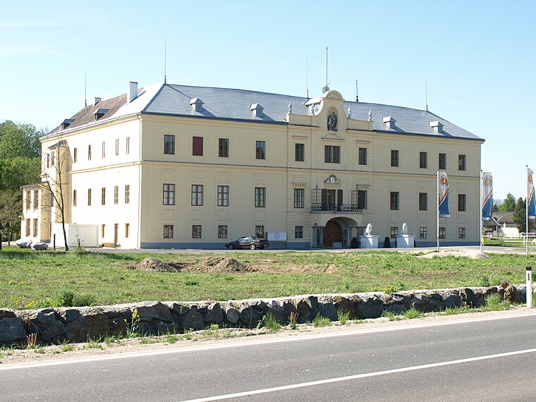 Schloss Hubertendorf Blindenmarkt is a castle, which is situated 210 metres east of Sicherheitsausstieg Schloss.
Johannes Nepomuk Neumarkt an der Ybbs
 Johannes Nepomuk Neumarkt an der Ybbs is situated 3 km east of Sicherheitsausstieg Schloss.
Pfarrkirche St. Martin-Karlsbach
Church
 Pfarrkirche St. Martin-Karlsbach is a church, which is situated 3½ km north of Sicherheitsausstieg Schloss.
Places in the Area
Nearby places include Persenbeug and Wieselburg.
Persenbeug
Village

Photo: Bwag, CC BY-SA 4.0.
Persenbeug is a village, which is situated 8 km northeast of Sicherheitsausstieg Schloss.
Wieselburg
Town

Photo: Wikimedia, CC BY-SA 3.0.
Wieselburg is a town in Lower Austria, Austria, located near the River Erlauf. Its name roughly translates to castle where two rivers meet, as there are two rivers that run together to create the Erlauf. Wieselburg is situated 9 km east of Sicherheitsausstieg Schloss.
Sicherheitsausstieg Schloss
- Type: Building
- Also known as: “Burgstaller Tunnel Sicherheitsausstieg 2 Schloss”
- Location: Steinakirchen am Forst, Scheibbs District, Lower Austria, Austria, Central Europe, Europe
- View on OpenStreetMap
Latitude
48.1331° or 48° 7′ 59″ northLongitude
15.01905° or 15° 1′ 9″ eastOperator
ÖBBOpen location code
8FWQ42M9+6JOpenStreetMap ID
way 432385905OpenStreetMap feature
building=service
This page is based on OpenStreetMap, Wikidata, and Wikimedia Commons.
We’d love your help improving our open data sources. Thank you for contributing.
Satellite Map
Discover Sicherheitsausstieg Schloss from above in high-definition satellite imagery.
Notable Places Nearby
Highlights include Burgstaller Kogel and Boomerang Action Park.
Nearby Places
Explore places such as mr wohndesign - mr officedesign and Silke Rametsteiner.
Lower Austria: Must-Visit Destinations
Delve into St. Pölten, Wiener Neustadt, Amstetten, and Klosterneuburg.
Curious Buildings to Discover
Uncover intriguing buildings from every corner of the globe.
About Mapcarta. Data © OpenStreetMap contributors and available under the Open Database License". Text is available under the CC BY-SA 4.0 license, except for photos, directions, and the map. Photo: Lonezor, CC BY-SA 3.0.