Raasakan koulu
Raasakan koulu is a school in Kannus, Kokkola, Central Ostrobothnia which is located on Siltakatu. Raasakan koulu is situated nearby to the pitch Raasakan kenttä, as well as near the park Törmätienpuisto.| Tap on a place to explore it |
- Type: School
- Also known as: “Takalo-Raasakan koulu”
- Address: Siltakatu 1, Kannus, 69100
Places of Interest Nearby
Highlights include Kannus railway station.
Kannus railway station
Railway station
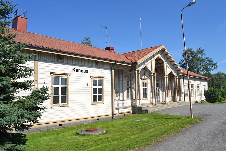 Kannus railway station is situated 690 metres southwest of Raasakan koulu.
Raasakan koulu
- Category: education
- Location: Kannus, Kokkola, Central Ostrobothnia, West Coast, Finland, Nordic countries, Europe
- View on OpenStreetMap
Latitude
63.90294° or 63° 54′ 11″ northLongitude
23.92462° or 23° 55′ 29″ eastOpen location code
9GM5WW3F+5ROpenStreetMap ID
way 432472617OpenStreetMap feature
amenity=school
This page is based on OpenStreetMap, Wikidata, and Wikimedia Commons.
We’d love your help improving our open data sources. Thank you for contributing.
Satellite Map
Discover Raasakan koulu from above in high-definition satellite imagery.
In Other Languages
“Raasakan koulu” goes by many names.
- Finnish: “Raasakan koulu”
Notable Places Nearby
Highlights include Raasakan kenttä and Törmätienpuisto.
Nearby Places
Explore places such as Juhani Vuorisen koulu and Kannuksen lukio.
Central Ostrobothnia: Must-Visit Destinations
Delve into Kokkola, Kaustinen, and Inland Central Ostrobothnia.
Curious Places to Discover
Uncover intriguing places from every corner of the globe.
About Mapcarta. Data © OpenStreetMap contributors and available under the Open Database License". Text is available under the CC BY-SA 4.0 license, except for photos, directions, and the map. Photo: Ypsilon from Finland, CC0.