Parkplatz an der Mehrzweckhalle
Parkplatz an der Mehrzweckhalle is a parking area in Sankt Sebastian, Mayen-Koblenz, Rhineland-Palatinate. Parkplatz an der Mehrzweckhalle is situated nearby to the square Dorfplatz St.Sebastian, as well as near the church Sebastianus-Kapelle.| Tap on a place to explore it |
Places of Interest Nearby
Highlights include Bendorfer Brücke and Schloss Engers.
Bendorfer Brücke
Bridge

Photo: Schaengel, CC BY-SA 3.0 de.
Bendorfer Brücke is a bridge, which is situated 780 metres east of Parkplatz an der Mehrzweckhalle.
Schloss Engers
Castle

Photo: Wolkenkratzer, CC BY-SA 3.0.
Schloss Engers is a Baroque-style palace in Engers, near Koblenz, Germany. It is situated on the banks of the Rhine river. Johann IX Philipp von Walderdorff, Prince-Elector of Trier, constructed the palace between 1759 and 1764 based on a design by the architect Johanness Seiz. Schloss Engers is situated 2 km northwest of Parkplatz an der Mehrzweckhalle.
St. Medardus
Church

Photo: RomkeHoekstra, CC BY-SA 4.0.
St. Medardus is a church, which is situated 1½ km northeast of Parkplatz an der Mehrzweckhalle.
Places in the Area
Nearby places include Kaltenengers and Bendorf.
Kaltenengers
Village
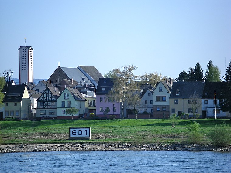
Photo: Volkes Stimme, CC BY-SA 3.0 de.
Kaltenengers is a municipality in the district of Mayen-Koblenz in Rhineland-Palatinate, western Germany.
Bendorf

Photo: Traveler100, CC BY-SA 4.0.
Bendorf is a small town in Rhineland-Palatinate. The town consists of the neighbourhoods of Bendorf, Sayn, Mülhofen, Stromberg.

Parkplatz an der Mehrzweckhalle
- Type: Parking area
- Parking: surface
- Category: transportation
- Location: Sankt Sebastian, Mayen-Koblenz, Rhineland-Palatinate, Germany, Central Europe, Europe
- View on OpenStreetMap
Latitude
50.41153° or 50° 24′ 42″ northLongitude
7.56425° or 7° 33′ 51″ eastOpen location code
9F29CH67+JPOpenStreetMap ID
way 435001980OpenStreetMap feature
amenity=parkingOpenStreetMap attribute
parking=surface
This page is based on OpenStreetMap, Wikidata, and Wikimedia Commons.
We’d love your help improving our open data sources. Thank you for contributing.
Satellite Map
Discover Parkplatz an der Mehrzweckhalle from above in high-definition satellite imagery.
Places with the Same Name
Discover other places named “Parkplatz an der Mehrzweckhalle”.
Notable Places Nearby
Highlights include Dorfplatz St.Sebastian and Sebastianus-Kapelle.
Nearby Places
Explore places such as Mehrzweckhalle and Metzgerei Heidger.
Rhineland-Palatinate: Must-Visit Destinations
Delve into Mainz, Trier, Koblenz, and Worms.
Curious Parking Areas to Discover
Uncover intriguing parking areas from every corner of the globe.
About Mapcarta. Data © OpenStreetMap contributors and available under the Open Database License". Text is available under the CC BY-SA 4.0 license, except for photos, directions, and the map. Photo: Traveler100, CC BY-SA 3.0.