Église Paroissiale Saint-Jean Baptiste
Église Paroissiale Saint-Jean Baptiste is a church in Saint-Jean-de-la-Ruelle, Arrondissement of Orléans, Centre-Val de Loire. Église Paroissiale Saint-Jean Baptiste is situated nearby to War memorial of Saint-Jean-de-la-Ruelle, as well as near the shopping center Vival.| Tap on a place to explore it |
Places of Interest Nearby
Highlights include Cathedral of the Holy Cross of Orléans and Orléans station.
Cathedral of the Holy Cross of Orléans
Church

Photo: DXR, CC BY-SA 4.0.
Orléans Cathedral is a Roman Catholic cathedral located in the city of Orléans, France. The cathedral is the seat of the Bishop of Orléans. Built on the ruins of a Roman temple from 1278 to 1329, the cathedral was partially destroyed in 1568 by the Huguenots during the French Wars of Religion and rebuilt in a Gothic style between 1601 and 1829. Cathedral of the Holy Cross of Orléans is situated 3 km southeast of Église Paroissiale Saint-Jean Baptiste.
Orléans station
Railway station

Photo: Croquant, CC BY-SA 4.0.
Orléans station is a railway station serving the city Orléans, Loiret department, central France. It is situated on the Paris–Bordeaux railway. The Gare d'Orléans is a terminus station, and therefore TGV and most other long-distance trains only serve the nearby Les Aubrais station. Orléans station is situated 2½ km east of Église Paroissiale Saint-Jean Baptiste.
Musée des Beaux-Arts d’Orléans
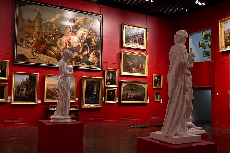
Photo: Croquant, CC BY-SA 3.0.
The Musée des beaux-arts d'Orléans is a museum in the city of Orléans in the Loiret department and the Centre-Val de Loire region in France. Founded in 1797, it is one of France's oldest provincial museums. Musée des Beaux-Arts d’Orléans is situated 3 km southeast of Église Paroissiale Saint-Jean Baptiste.
Places in the Area
Nearby places include Saint-Jean-de-la-Ruelle and Orléans.
Saint-Jean-de-la-Ruelle
Town

Photo: Croquant, CC BY-SA 4.0.
Saint-Jean-de-la-Ruelle is a commune in the Loiret department in the administrative region of Centre-Val de Loire, France. It is located about 3.5 km from Orléans.
Orléans
 Orleans is the capital of the Centre-Val de Loire region of north-central France, located some 120 km south-west of the French capital, Paris. The city has just above 100,000 citizens, with a total of 400,000 in the metropolitan area.
Fleury-les-Aubrais
Town

Photo: Wikifrédéric, CC BY-SA 3.0.
Fleury-les-Aubrais is a commune in the Loiret department, Centre-Val de Loire, France. It is a northern suburb of Orléans. As a part of German-occupied France, its railway station was destroyed in 1944 by the Combined Bomber Offensive. Fleury-les-Aubrais is situated 4 km northeast of Église Paroissiale Saint-Jean Baptiste.
Église Paroissiale Saint-Jean Baptiste
- Type: Church
- Categories: building, place of worship, and religion
- Location: Saint-Jean-de-la-Ruelle, Arrondissement of Orléans, Loiret, Centre-Val de Loire, France, Europe
- View on OpenStreetMap
Latitude
47.91407° or 47° 54′ 51″ northLongitude
1.87444° or 1° 52′ 28″ eastOpen location code
8FV3WV7F+JQOpenStreetMap ID
way 437490907OpenStreetMap feature
amenity=place_of_worshipOpenStreetMap feature
building=church
This page is based on OpenStreetMap, Wikidata, and Wikimedia Commons.
We’d love your help improving our open data sources. Thank you for contributing.
Satellite Map
Discover Église Paroissiale Saint-Jean Baptiste from above in high-definition satellite imagery.
Places with the Same Name
Discover other places named “Église Paroissiale Saint-Jean Baptiste”.
Notable Places Nearby
Highlights include War memorial of Saint-Jean-de-la-Ruelle and Vival.
Nearby Places
Explore places such as Mairie de St Jean de la Ruelle and Crédit Agricole.
Centre-Val de Loire: Must-Visit Destinations
Delve into Orléans, Tours, Chartres, and Bourges.
Curious Churches to Discover
Uncover intriguing churches from every corner of the globe.
About Mapcarta. Data © OpenStreetMap contributors and available under the Open Database License". Text is available under the CC BY-SA 4.0 license, except for photos, directions, and the map. Photo: PMRMaeyaert, CC BY-SA 3.0.