Wall of Derry
Wall of Derry is in Derry City and Strabane, Northern Ireland. Wall of Derry is situated nearby to Verbal Arts Centre, as well as near the scenic viewpoint Double Bastion.| Tap on a place to explore it |
Places of Interest Nearby
Highlights include St Columb’s Cathedral and Verbal Arts Centre.
St Columb’s Cathedral
Church
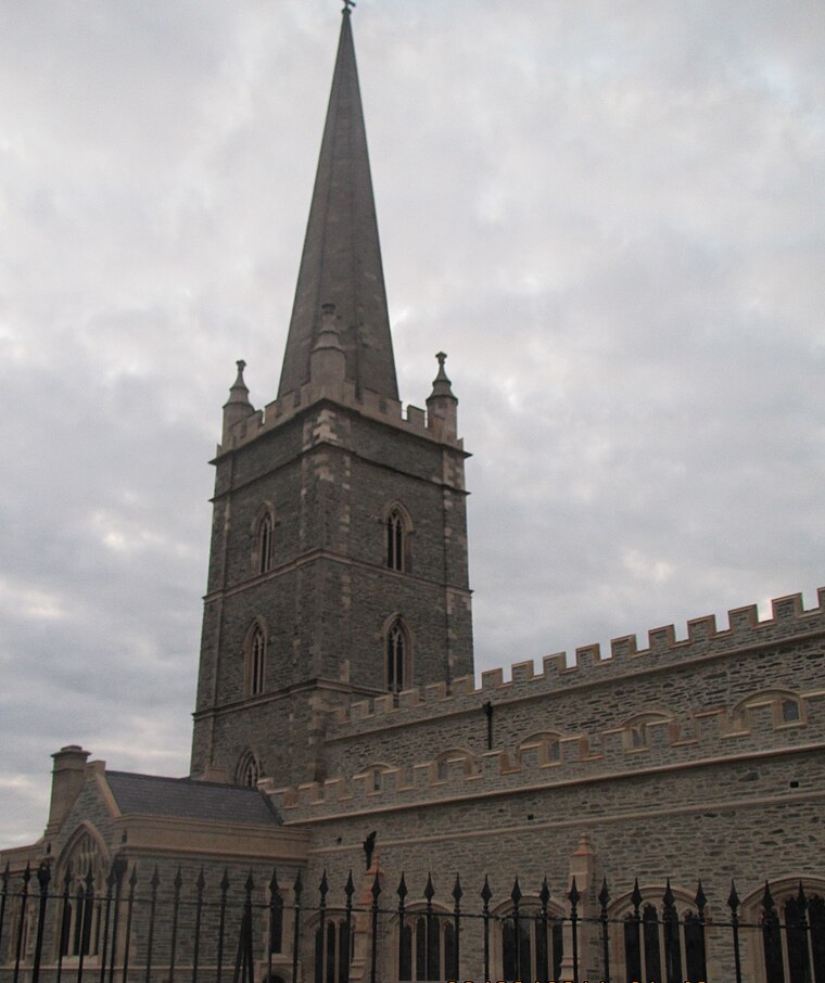
Photo: Romeparis, CC BY-SA 3.0.
St Columb's Cathedral in the walled city of Derry, Northern Ireland, is the cathedral church and episcopal see of the Church of Ireland's Diocese of Derry and Raphoe. St Columb’s Cathedral is situated 370 feet east of Wall of Derry.
Verbal Arts Centre
The Verbal Arts Centre is based in Derry, Northern Ireland, and is a centre for the development of the verbal arts and literacy. It was established in 1992 as an educational charity.St Columba’s Church
Church

Photo: Ardfern, CC BY-SA 3.0.
St Columba's Church, Long Tower is a Roman Catholic Church in the Diocese of Derry. It is located in the heart of the city of Derry in Northern Ireland. St Columba’s Church is situated 830 feet west of Wall of Derry.
Places in the Area
Nearby places include Derry and Brandywell.
Derry

Photo: AlasdairW, CC BY-SA 3.0.
Derry or Londonderry is the second city of Northern Ireland, with a population of 85,000 in 2021. It's on the estuary of the River Foyle and historically within County Londonderry, which has been abolished as a unit of governance so the city is now part of Derry and Strabane District.

Altnagelvin
Suburb

Photo: Kay Atherton, CC BY-SA 2.0.
Altnagelvin is a townland in County Londonderry, Northern Ireland. It is also the name of an electoral ward in Derry and Strabane district. Formerly a small village, it has been absorbed into the Waterside neighbourhood of Derry.
Wall of Derry
Latitude
54.99372° or 54° 59′ 37″ northLongitude
-7.32473° or 7° 19′ 29″ westOpen location code
9C6JXMVG+F4OpenStreetMap ID
way 439065116OpenStreetMap feature
highway=pedestrian
This page is based on OpenStreetMap, Wikidata, and Wikimedia Commons.
We’d love your help improving our open data sources. Thank you for contributing.
Satellite Map
Discover Wall of Derry from above in high-definition satellite imagery.
Places with the Same Name
Discover other places named “Wall of Derry”.
Notable Places Nearby
Highlights include Double Bastion and Church Bastion.
Nearby Places
Explore places such as Bishop Street Car Park and Fountain Primary School.
Northern Ireland: Must-Visit Destinations
Delve into Belfast, Derry, Giant’s Causeway, and Armagh.
Curious Places to Discover
Uncover intriguing places from every corner of the globe.
About Mapcarta. Data © OpenStreetMap contributors and available under the Open Database License". Text is available under the CC BY-SA 4.0 license, except for photos, directions, and the map. Photo: Chmee2, CC BY 3.0.