Parramatta City Motel
Parramatta City Motel is a motel in Parramatta, Sydney, New South Wales. Parramatta City Motel is situated nearby to the health club UFC, as well as near the shopping center Westfield Parramatta.| Tap on a place to explore it |
Places of Interest Nearby
Highlights include Old Government House and Parramatta Town Hall.
Old Government House
Historic building

Photo: Yewenyi, CC BY-SA 3.0.
Old Government House is a heritage-listed former "country" residence used by ten early Governors of the then-Colony of New South Wales, between 1800 and 1847, and which is located in Parramatta Park in Parramatta, in the suburbs of Western Sydney, New South Wales, Australia. Old Government House is situated 800 metres north of Parramatta City Motel.
Parramatta Town Hall
Town hall
 The Parramatta Town Hall is a heritage-listed town hall located in the Greater Western Sydney suburb of Parramatta, New South Wales, Australia. Designed by Messrs Blackmann and Parkes in the Victorian Free Classical architectural style, the town hall was completed in 1883 at a cost of A£2,300 to serve as the town hall and municipal chamber for the Borough of Parramatta. Parramatta Town Hall is situated 500 metres northeast of Parramatta City Motel.
Centenary Square
Square
Centenary Square, formerly known as Bicentennial Square, is a civic square located in the heart of Parramatta, New South Wales, Australia. It faces the 1883 Parramatta Town Hall and St John's Cathedral. Centenary Square is situated 490 metres northeast of Parramatta City Motel.
Places in the Area
Nearby places include Rydalmere and Dundas.
Rydalmere
Suburb
Rydalmere is a suburb of Sydney, in the state of New South Wales, Australia. Rydalmere is approximately 21 kilometres west of the Sydney central business district in the local government area of the City of Parramatta. Rydalmere is situated 4 km east of Parramatta City Motel.
Dundas
Suburb
Dundas is a suburb of Sydney, New South Wales, Australia. Dundas is located 21 kilometres north-west of the Sydney central business district, in the local government area of the City of Parramatta, and the electoral division of Bennelong. Dundas is situated 4½ km northeast of Parramatta City Motel.
Newington
Suburb
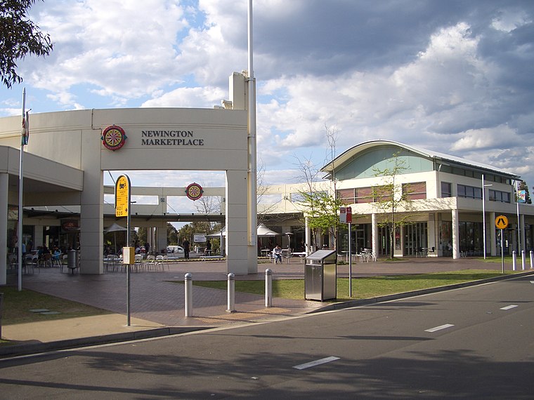 Newington is a western suburb of Sydney, in the state of New South Wales, Australia. It is 16 kilometres west of the Sydney central business district, in the local government area of City of Parramatta. Newington is situated 5 km east of Parramatta City Motel.
Parramatta City Motel
- Type: Motel
- Categories: building, tourism, and accommodation
- Location: Parramatta, Sydney, New South Wales, Australia, Oceania
- View on OpenStreetMap
Latitude
-33.81905° or 33° 49′ 9″ southLongitude
150.99991° or 150° 59′ 60″ eastOpen location code
4RRG5XJX+9XOpenStreetMap ID
way 442978988OpenStreetMap feature
building=yesOpenStreetMap feature
tourism=motel
This page is based on OpenStreetMap, Wikidata, and Wikimedia Commons.
We’d love your help improving our open data sources. Thank you for contributing.
Satellite Map
Discover Parramatta City Motel from above in high-definition satellite imagery.
Notable Places Nearby
Highlights include UFC and Westfield Parramatta.
Nearby Places
Explore places such as The Marsden Hotel and Wentworth Gardens.
Sydney: Must-Visit Destinations
Delve into Eastern suburbs, City Centre, Sydney Harbour National Park, and Inner West.
Curious Motels to Discover
Uncover intriguing motels from every corner of the globe.
About Mapcarta. Data © OpenStreetMap contributors and available under the Open Database License". Text is available under the CC BY-SA 4.0 license, except for photos, directions, and the map. Photo: Wikimedia, CC BY-SA 3.0.