Colegio Público Rural Agrupado Los Bardales
Colegio Público Rural Agrupado Los Bardales is a school in Aldeacipreste, Salamanca, Castile and León. Colegio Público Rural Agrupado Los Bardales is situated nearby to the church Ermita del Cristo, as well as near Iglesia de Nuestra Señora de la Asunción.| Tap on a place to explore it |
Places of Interest Nearby
Highlights include Iglesia de Nuestra Señora de la Asunción and Castle of Montemayor del Río.
Iglesia de Nuestra Señora de la Asunción
Church

Photo: Hovallef, CC BY-SA 4.0.
Iglesia de Nuestra Señora de la Asunción is a church, which is situated 260 metres west of Colegio Público Rural Agrupado Los Bardales.
Castle of Montemayor del Río
Castle

Photo: Eugeniobb, Public domain.
Castle of Montemayor del Río is situated 3½ km south of Colegio Público Rural Agrupado Los Bardales.
Places in the Area
Nearby places include Montemayor del Río and Horcajo de Montemayor.
Montemayor del Río
Village

Photo: Montemayorense, CC BY-SA 4.0.
Montemayor del Río is a municipality located in the province of Salamanca, Castile and León, Spain. As of 2016 the municipality has a population of 296 inhabitants. Montemayor del Río is situated 3½ km south of Colegio Público Rural Agrupado Los Bardales.
Horcajo de Montemayor
Village

Photo: Ramajero, CC BY-SA 4.0.
Horcajo de Montemayor is a village and municipality in the province of Salamanca, western Spain, part of the autonomous community of Castile-Leon. It is located 90 kilometres from the provincial capital city of Salamanca and has a population of 154 people. Horcajo de Montemayor is situated 4½ km north of Colegio Público Rural Agrupado Los Bardales.
Peñacaballera
Village
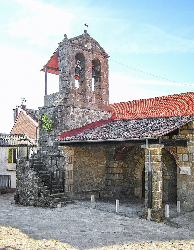
Photo: Ramajero, CC BY-SA 4.0.
Peñacaballera is a municipality located in the province of Salamanca, Castile and León, Spain. As of 2016 the municipality has a population of 149 inhabitants. Peñacaballera is situated 5 km southeast of Colegio Público Rural Agrupado Los Bardales.
Colegio Público Rural Agrupado Los Bardales
- Type: School
- Category: education
- Location: Aldeacipreste, Salamanca, Castile and León, Central Spain, Spain, Iberia, Europe
- View on OpenStreetMap
Latitude
40.37975° or 40° 22′ 47″ northLongitude
-5.89407° or 5° 53′ 39″ westOpen location code
8CGP94H4+V9OpenStreetMap ID
way 445887550OpenStreetMap feature
amenity=school
This page is based on OpenStreetMap, Wikidata, and Wikimedia Commons.
We’d love your help improving our open data sources. Thank you for contributing.
Satellite Map
Discover Colegio Público Rural Agrupado Los Bardales from above in high-definition satellite imagery.
Notable Places Nearby
Highlights include Ermita del Cristo and Ayuntamiento de Aldeacipreste.
Nearby Places
Explore places such as Consultorio Médico de Valbuena and Torre del Homenaje.
Castile and León: Must-Visit Destinations
Delve into Valladolid, Salamanca, Segovia, and León.
Curious Places to Discover
Uncover intriguing places from every corner of the globe.
About Mapcarta. Data © OpenStreetMap contributors and available under the Open Database License". Text is available under the CC BY-SA 4.0 license, except for photos, directions, and the map. Photo: Xemenendura, CC BY-SA 4.0.